
OuterMap

Parks in Onamia

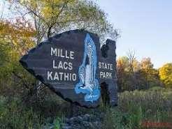
Onamia, Minnesota, United States has 1 park to explore on OuterMap: Mille Lacs Kathio State Park. It has 8 mapped trails and 33 points of interest.

Places

  1. #1 · Mille Lacs Kathio State Park

    0.0(0)ParkOnamia8 trails

    Experience over 10,000 acres of hardwood forest, pine stands, lakes and wetlands within the park. View the Rum River as it flows through the park from its source on the southwest shore of Mille Lacs Lake. For thousands of years people have chosen this abundant landscape as a premier location to harvest resources and to live. Archaeologists have identified over 30 significant sites within the park, indicating over 9,000 years of human interaction with the landscape. The park is recognized as a National Historic Landmark to commemorate the meeting of French explorers and Dakota villagers in the 1600s. The designation also recognizes Kathio as the ancient homeland of the Mdewakanton Dakota nation and the historic homeland of the Mille Lacs Band of Ojibwe nation. Learn more about this rich history as you explore the park.

Frequently Asked Questions

How many parks are there in Onamia?

OuterMap has 1 park in Onamia, Minnesota, United States: Mille Lacs Kathio State Park.

What is the longest trail in Onamia?

The longest mapped trail in Onamia is Hike/Horse at Mille Lacs Kathio State Park, at 13.9 miles.

Where can I camp in Onamia?

Mille Lacs Kathio State Park has campsites marked on its map.

Where can I have a picnic in Onamia?

Mille Lacs Kathio State Park has picnic areas marked on its map.

Download The App & Explore Anywhere

Explore interactive maps, discover trails and points of interest, and navigate confidently with the OuterMap mobile app — with detailed information and offline access wherever you go.