
#1 · Cascade River State Park
0.0(0)ParkGrand Marais15 trails
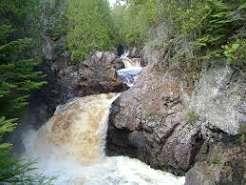
The Cascade River plunges 120 feet through a deep, twisting gorge on its 17-mile journey to meet Lake Superior. The result is a spectacular series of cascades for which the river was named. Stand at one of the viewing spots above the river to feel the vibration of the rushing water as it cuts through ancient basalt lava flows. Smaller water features like Spruce, Indian Camp, and Cutface creeks also move through the park. Trails wind from Lake Superior up to the Sawtooth Mountains with their panoramic view of the North Shore. Pass through the boreal hardwood-conifer forest of aspen, birch, fir, spruce and cedar. You may glimpse moose, wolves, pine martens, bears or numerous birds. Many of the trails and facilities that you see in the park were built by men stationed here at a Civilian Conservation Corps camp in the 1930s. Cascade River State Park was established in 1957 so that future generations could experience these unique natural and historic features.