OuterMap Studio, Create Your Map
Convert any static map into a dynamic, branded mobile journey. With AI-powered extraction of trails and points of interest, deliver a seamless wayfinding experience your visitors can trust, online or offline.
< 30 min
From upload to live map
iOS & Android
Native apps, one dashboard
Offline Maps
Navigate trails & POIs without signal
AI-Powered
Auto trail & POI detection
No developers. No GIS expertise. No months of waiting. Just upload, enrich, and share, your visitors get a live branded experience the same day.
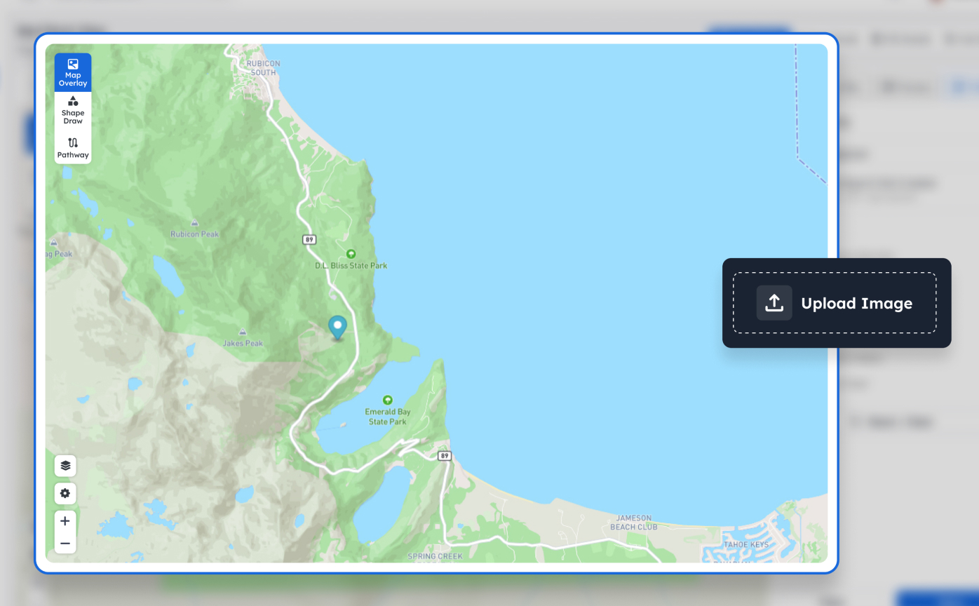
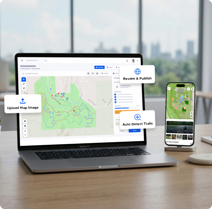
Drop any floor plan, trail layout, or venue map into OuterMap. Supports PNG, JPG, PDF, and GeoTIFF, no GIS expertise or specialist software needed.
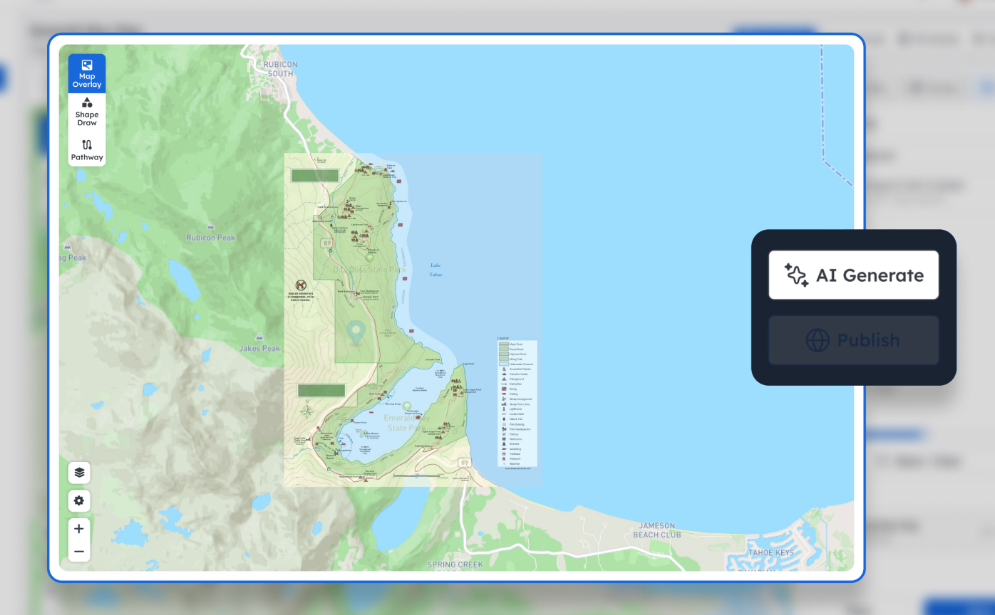
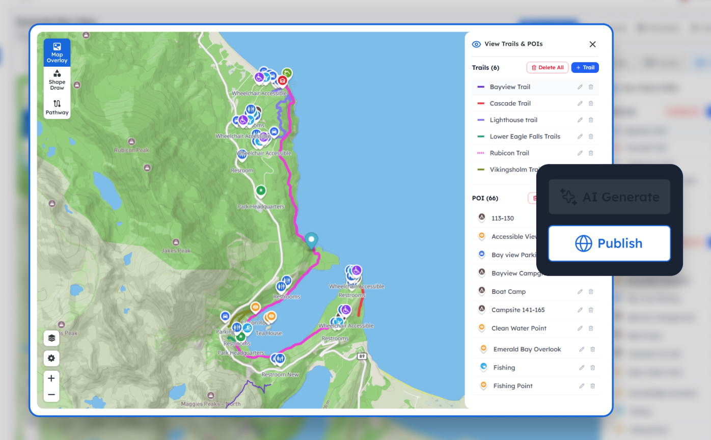
Floor plans, aerial photos, trail mapsOur AI engine instantly identifies trails, paths, and points of interest, then hands you a clean, editable draft to add guides, exhibit info, booth listings, or safety alerts.
Points of interest, guides, directions, infoPublish to iOS and Android with one click. Distribute via QR code, direct link, or embed directly into your website. Visitors get a fully branded, offline-capable experience instantly.
QR code, shareable link, or embedded appAverage setup time: under 30 minutes
Watch a confused park visitor turn confident as a static map becomes a fully interactive mobile experience. Parks, campuses, exhibitions: any space, instantly navigable.
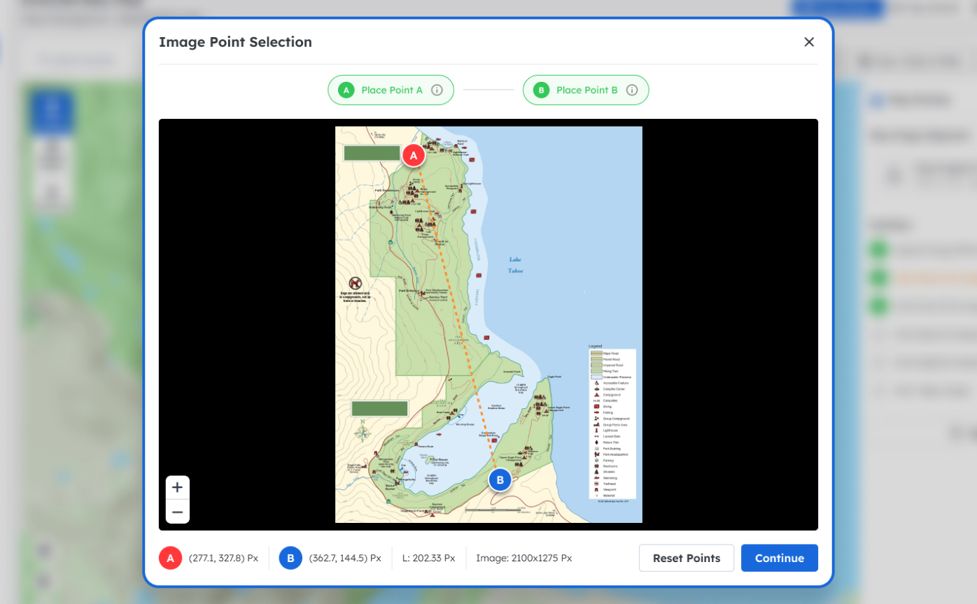
From a paper map to a live mobile app in five simple steps, create, upload, align, let AI do the heavy lifting, and publish to iOS and Android.
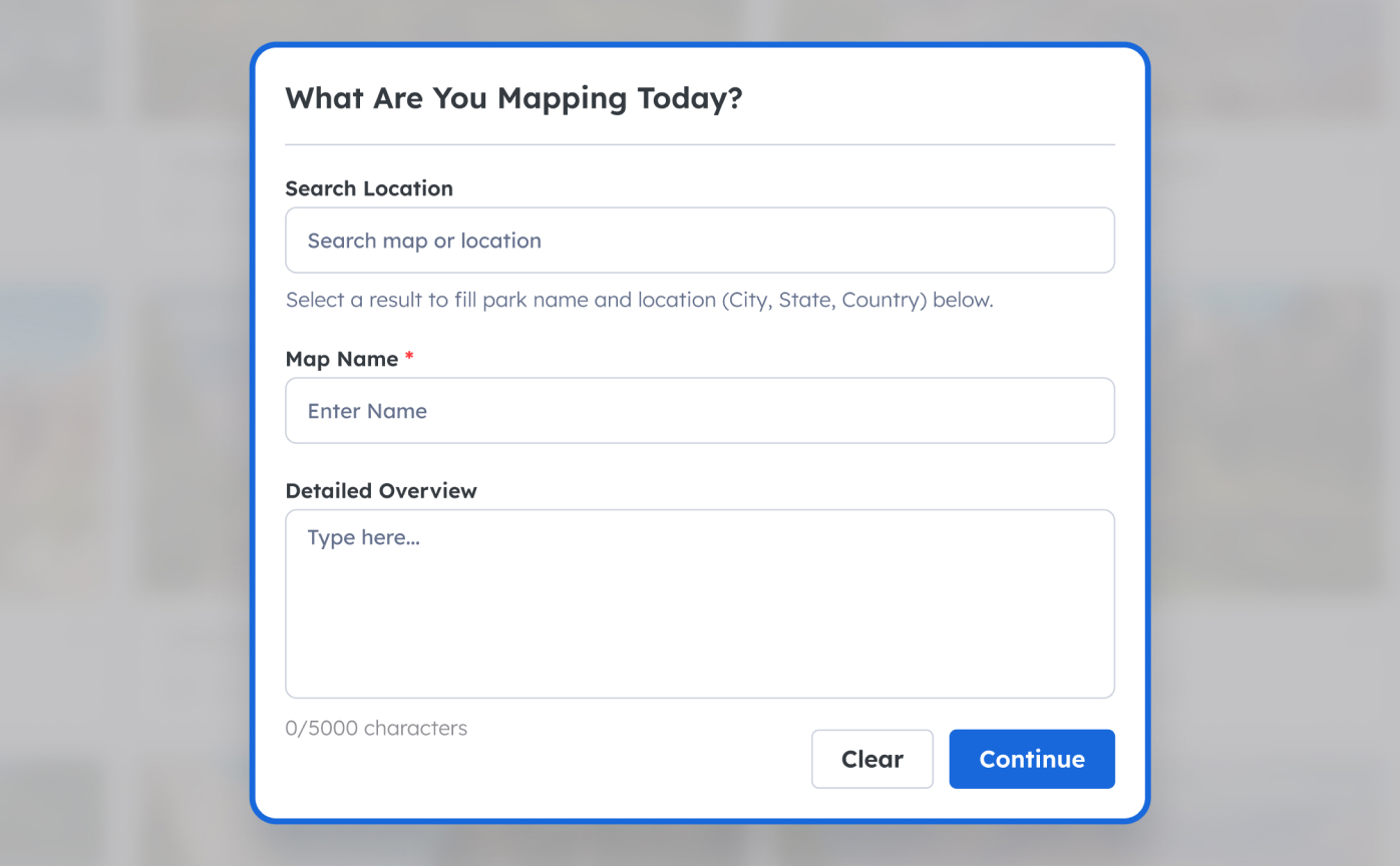
Start by creating a new map and adding its initial details, name, location, and the basics that define your space. It takes less than a minute to begin.
Whether you manage a national park, a cultural institution, or a world-class event, OuterMap turns your static map into a live, branded wayfinding experience in minutes.

Give hikers, cyclists, and nature-seekers real-time guidance they can trust even when connectivity drops. Upload your trail map and go live the same day.

Transform how visitors explore your collection. Replace printed maps and hired guides with a personalized, always-available digital companion, branded to your institution.

Turn any venue layout, floor plan, exhibitor grid, or campus map, into a live, searchable attendee experience. From GITEX to city festivals, scale without friction.
From faster deployment to smarter data management, OuterMap gives decision makers the tools needed to launch reliable mapping experiences with confidence.


80%
Faster deployment
4.9★
App Store Rating
Upload a map image, align it to Mapbox, add POIs and trails, publish, and deliver a branded mobile experience with offline support. Built for decision makers who need fast, accurate wayfinding and engagement for their visitors.
Multi-tenant map management platform with role control, AI extraction, and validation workflows.
Guest-friendly iOS & Android apps with search, navigation, POI details, and offline downloads.
Upload a map and let AI detect routes, POIs, and labels to instantly generate a draft you can refine.
Launch your first AI-powered wayfinding map in minutes, completely free. When your program grows across sites, teams, and integrations, our Enterprise plan meets you there with the power, support, and scale your organization deserves.
Perfect for pilots, evaluations, and single-site teams ready to ship their first branded wayfinding app, no credit card required.
Built for multi-site operators, venues, and networks that need unlimited scale, deep integrations, and dedicated partnership.
More plans, usage-based tiers, and regional pricing are on the roadmap.
Join the early-access community, enroll today to lock in launch benefits and shape the product roadmap with us.
Everything you need to know before committing a minute of your team's time.
Most venues are live in under 30 minutes. You upload your map image, our AI identifies trails and points of interest automatically, and you review and publish. No GIS expertise or specialist software required.
No. OuterMap supports full offline access. Visitors can download the map before they arrive and navigate trails, read POI details, and access all content without any cellular or Wi-Fi signal.
We support PNG, JPG, PDF, and GeoTIFF. Whether you have a professional cartographic file or a simple scanned paper map, OuterMap can align and publish it.
Yes. Enterprise plans include full white-labeling, your logo, brand colors, custom domain, and splash screen. Visitors see your brand, not OuterMap's.
When you upload your map image, our computer-vision model detects paths, junctions, and labeled points of interest. It produces a clean, editable draft in seconds. You review each item, add descriptions, photos, and metadata, then publish.
Changes publish instantly. Add a POI, update a trail status, or swap your map image, visitors see the latest version the next time they open the app, even if they're already on-site.
The Free plan supports up to 25 POIs and 5 trails, ideal for small venues and pilots. Enterprise plans are unlimited, covering large parks, multi-site festivals, and museum campuses with thousands of points.
Enterprise customers get a dedicated onboarding specialist who walks your team through setup, AI extraction, and publishing in a live session. Free plan users have access to our help docs, video tutorials, and community forum.
Still have questions? Talk to our team →
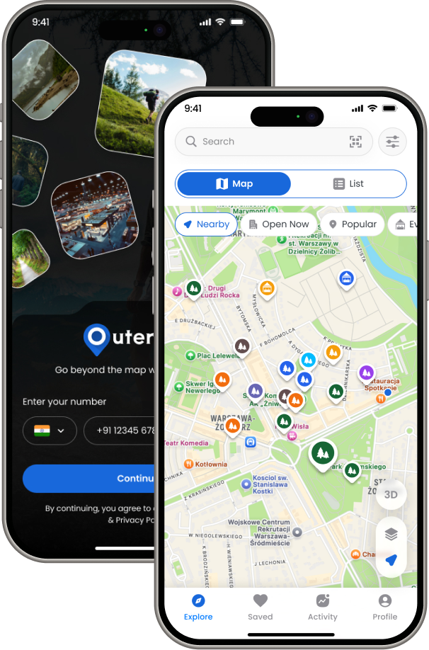
Your maps, trails, and destinations always with you, even offline.
Explore interactive maps, discover trails and POIs, and navigate confidently with the OuterMap mobile app, with detailed information and offline access wherever you go.


Now available on iOS and Android, download OuterMap free.
Tell us about your organization, map sources, and timeline. We'll help you go from image to published mobile map.