
OuterMap

Parks and expos in United States

4.5(28 reviews)

United States has 96 parks and expos to explore on OuterMap, including Red Rock State Park Miller Visitor Center New, Pelham Bay Park Hiking Trails and Hickory Run State Park. Between them they have 824 mapped trails and 2583 points of interest. The regions with the most places are Minnesota (53), Colorado (13) and Massachusetts (7).

Top places

  1. #1 · Delaware Water Gap

    5.0(1)ParkDelaware Water Gap27 trails

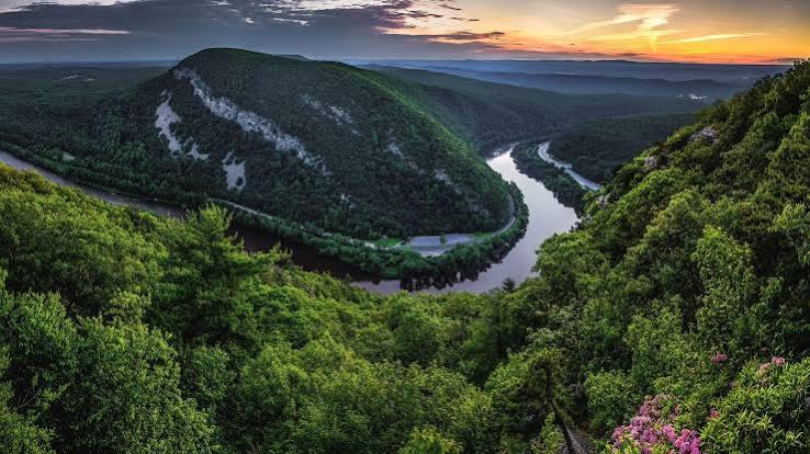
    Delaware Water Gap National Recreation Area preserves 70,000 acres of forested mountains, river valleys, and historic landmarks along the Delaware River. Highlights include over 100 miles of hiking trails—including a section of the Appalachian Trail—scenic waterfalls such as Raymondskill Falls and Dingmans Falls, and popular vantage points like Mount Tammany and Mount Minsi. Visitors enjoy canoeing, kayaking, fishing, cross-country skiing, and exploring historic sites like Millbrook Village.

  2. #2 · Emerald Bay Map

    4.6(10)ParkSouth Lake Tahoe6 trails

    Emerald Bay State Park is a state park of California in the United States, centered on Lake Tahoe's Emerald Bay, a National Natural Landmark. Park features include Eagle Falls and Vikingsholm, a 38-room mansion that is considered one of the finest examples of Scandinavian architecture in the United States. The architect was Leonard Palme, who was hired by his aunt Lora Josephine Knight to design and build Vikingsholm.

  3. #3 · Antelope Valley California Poppy Reserve 🌼🌄

    4.4(8)ParkLancaster7 trails

    Antelope Valley California Poppy Reserve 🌼🌄 As of April 2026, the reserve is in peak wildflower season, with rolling hills beautifully blanketed in vibrant orange California poppy 🌿 Bloom intensity may vary daily depending on weather like wind and temperature. 🌸 Best Time to Visit ⏰ Park Hours: Sunrise to Sunset (daily) 🌞 Best Viewing: Mid-morning (9:00 AM – 10:00 AM) 🌬️ Poppies may close in the afternoon if it gets too windy or cold 🚗 Parking Information 🚙 Standard Vehicle: $10.00 👵 Senior (62+): $9.00 🚌 Small Bus (9–24): $50.00 🚌 Large Bus (25+): $100.00 📍 Location 📌 15101 Lancaster Road, Lancaster, California 🛣️ ~15 miles west of Highway 14 ⚠️ Important Rules & Tips 🚫 Stay on Trails: Protect delicate poppy fields 🐕 No Dogs Allowed: (Service animals permitted) 🐍 Wildlife Alert: Watch for Mojave green rattlesnakes—stay on marked paths 🌿 Respect nature to preserve its beauty 🏛️ Visitor Facilities Explore Jane S. Pinheiro Interpretive Center 🎨 Wildflower exhibits 🛍️ Gift shop 🚻 Visitor amenities 🌄 Nearby Attractions 🌳 Arthur B. Ripley Desert Woodland State Park (7 miles west) – Joshua trees & desert woodland ⛰️ Saddleback Butte State Park (32 miles east) – Camping & diverse wildflowers 🌟 Why Visit Now 🌼 Peak bloom creates a once-a-year natural spectacle 📸 Perfect for photography, hiking, and relaxation 🌿 A peaceful escape into California’s desert beauty 🌼 Plan Your Visit Witness the magic of endless цвет blooms, breathe in fresh desert air, and create unforgettable memories in one of California’s most iconic spring destinations 🌄🌼

  4. #4 · Ahjumawi Lava Springs State Park

    4.4(8)ParkMcArthur5 trails

    Ahjumawi Lava Springs State Park is a state park of California in the United States. It is located in remote northeastern Shasta County and is only accessible to the public by boat. The park is 4 miles (6.4 km) in length and no more than 1 mile (1.6 km) wide, and has over 13 miles (21 km) of shoreline.

  5. #6 · Lake Louise State Park

    0.0(0)ParkLe Roy3 trails

    The park’s lake was created when early settlers built a dam on the Upper Iowa River to power a gristmill, an important business for the growing frontier community of Le Roy. Later in time, the Hambrecht Family donated several acres along the lake as a recreation area called Wildwood Park. The lake was named “Louise” after a family member. The city of Le Roy donated Wildwood Park to the state in 1962, and Lake Louise State Park was established. Today, at 849 acres, the park offers woodlands and restored prairies with abundant wildflowers and wildlife. The park also includes the confluence of the Upper Iowa and Little Iowa rivers and features numerous sinkholes

  6. #7 · Myre-Big Island State Park

    0.0(0)ParkAlbert Lea9 trails

    Myre-Big Island State Park is an oasis of natural diversity. The park was created in 1947 to protect unique geologic features, plant life and human history. What began with 116 acres on Big Island now encompasses over 1,700 acres of rolling hills, ponds and marshes along the shores of Albert Lea Lake. The oak savanna landscape is surrounded by agricultural land. The area has been used by humans for over 9,000 years. Visit today and discover birding, hiking, biking, canoeing, kayaking, snowshoeing, camping and much more.

  7. #8 · Rice Lake State Park

    0.0(0)ParkOwatonna3 trails

    Long before this landscape held a state park, it was part of a vast oak savanna known as Minnesota’s southern oak barrens. Imagine a sea of prairie grasses and wildflowers scattered with burr oak trees. Human activities have long since altered this landscape, but efforts are underway to restore it. A walk through the park now reveals remnants of old burr oaks and restored prairie plants. In the middle of this unique habitat is Rice Lake, a headwater of the Zumbro River. In the past, American Indians harvested wild rice here. Today, the shallow waters and marshy edges attract many waterfowl during migrations.

  8. #9 · Carley State Park

    0.0(0)ParkPlainview4 trails

    Visit the park in spring for a parade of early wildflowers, or in the fall for a display of colorful oaks and maples. Come during any season to glimpse the towering white pines that first prompted the park’s creation. State Senator James A. Carley and the Ernestina Bolt family donatedthis land in 1948 to preserve an outstanding groveof white pines found here. Look opposite thepicnic area and you will still see some of thesegiants in the river valley today. In addition to thepines, spring wildflowers and numerous birdspecies, the park also protects a portion of theBlufflands Landscape Region. This is a unique areain southeastern Minnesota that features highbluffs, deep valleys and rolling uplands.

  9. #10 · Whitewater State Park

    0.0(0)ParkAltura6 trails

    Established in 1919, the park protects one of the most scenic sections of the historic Whitewater Valley. Rare geology in this unglaciated Driftless Area supports diverse ecosystems, dramatic landscapes and unique recreational opportunities. Much of the park was developed by the Civilian Conservation Corps and the Works Progress Administration as a result of the Great Depression. Today, the park welcomes over 250,000 visitors each year and serves as a gateway and information center for the nearby 27,000-acre Whitewater Wildlife Management Area. An active Friends Group helps support many park projects and activities.

Showing results 1–10 of 95

Reviews for United States

Shubham Rahevar

6 months ago

Amazing views! you could spend hours exploring the trails to vikingsholm & Lower eagle falls! Loved it 😍

Emerald Bay Map

Shubham Rahevar

6 months ago

Hands down the most scenic spot at Lake Tahoe. Crystal clear water, lush forest trails, and rich history with Vikingsholm. Cannot recommend enough!

Emerald Bay Map

Shubham Rahevar

6 months ago

Hands down the most scenic spot at Lake Tahoe. Crystal clear water, lush forest trails, and rich history with Vikingsholm. Cannot recommend enough!

Ahjumawi Lava Springs State Park

Frequently Asked Questions

How many parks and expos are there in United States?

OuterMap has 96 parks and expos in United States, including Red Rock State Park Miller Visitor Center New, Pelham Bay Park Hiking Trails, Hickory Run State Park, Delaware Water Gap and Itasca State Park.

Which regions in United States have the most parks and expos?

On OuterMap, the most are in Minnesota (53), Colorado (13) and Massachusetts (7).

Which place in United States has the most trails?

Red Rock State Park Miller Visitor Center New has the most mapped trails in United States, with 31. Next is Hickory Run State Park, with 29.

What is the longest trail in United States?

The longest mapped trail in United States is Hiking/Horseback (Heart of the Lakes Trail) at Maplewood State Park, at 22.7 miles.

Where can I camp in United States?

Afton State Park, Ahjumawi Lava Springs State Park, Banning State Park, Bear Head Lake State Park, Beartown State Forest and 56 more have campsites marked on their maps.

Where can I have a picnic in United States?

Afton State Park, Ahjumawi Lava Springs State Park, Antelope Valley California Poppy Reserve 🌼🌄, Banning State Park, Bear Head Lake State Park and 69 more have picnic areas marked on their maps.

Which parks and expos in United States have wheelchair-accessible places?

Ahjumawi Lava Springs State Park, Eldorado Canyon State Park, Emerald Bay Map, Gooseberry Falls State Park, John Martin Reservoir State Park and 2 more have places marked as wheelchair accessible on their maps.

Are there expos in United States?

Yes, OuterMap has 1 expo in United States: NRPA Annual Conference - 2026.

Explore United States

Regions

Places

Download The App & Explore Anywhere

Explore interactive maps, discover trails and points of interest, and navigate confidently with the OuterMap mobile app — with detailed information and offline access wherever you go.