
OuterMap

Parks in Grand Portage

Grand Portage, Minnesota, United States has 1 park to explore on OuterMap: Grand Portage State Park. It has 4 mapped trails and 17 points of interest.

Places

  1. #1 · Grand Portage State Park

    0.0(0)ParkGrand Portage4 trails

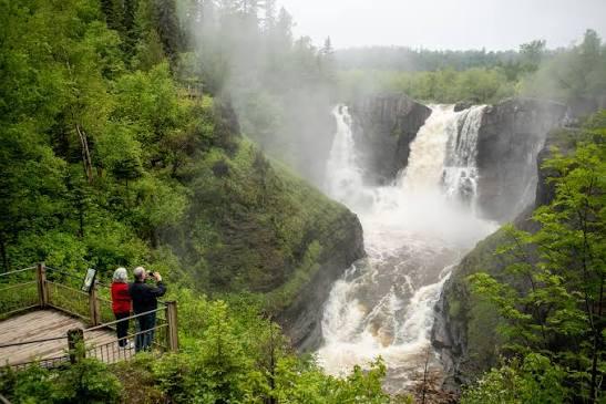
    Here you can experience a unique sense of place through a partnership between the State of Minnesota and the Anishinabe people of Grand Portage. Established in 1989, Grand Portage is not only a state park but a Class 1 Highway Rest Area and Explore Minnesota Travel Information Center. Hike six miles of trails with two beautiful waterfalls and ridgetop overlooks of Lake Superior and the Pigeon River Valley. The river forms the northern boundary of the park and is the international boundary line between the United States and Canada. The main attraction is High Falls, the tallest waterfall in Minnesota with a drop of 120 feet. The spectacular scenery sets the stage for recreational opportunities such as hiking, snowshoeing, photography and picnicking

Frequently Asked Questions

How many parks are there in Grand Portage?

OuterMap has 1 park in Grand Portage, Minnesota, United States: Grand Portage State Park.

What is the longest trail in Grand Portage?

The longest mapped trail in Grand Portage is Hiking (Middle Falls Trail) at Grand Portage State Park, at 2.3 miles.

Where can I have a picnic in Grand Portage?

Grand Portage State Park has picnic areas marked on its map.

Download The App & Explore Anywhere

Explore interactive maps, discover trails and points of interest, and navigate confidently with the OuterMap mobile app — with detailed information and offline access wherever you go.