
OuterMap

Parks and expos in Pennsylvania

5.0(1 review)

Pennsylvania, United States has 5 parks and expos to explore on OuterMap, including Hickory Run State Park, Delaware Water Gap and Ohiopyle State Park. Between them they have 92 mapped trails and 167 points of interest. The cities with the most places are Delaware Water Gap (1), Ohiopyle (1) and Orefield (1).

Top places

  1. #1 · Delaware Water Gap

    5.0(1)ParkDelaware Water Gap27 trails

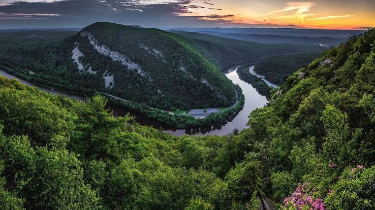
    Delaware Water Gap National Recreation Area preserves 70,000 acres of forested mountains, river valleys, and historic landmarks along the Delaware River. Highlights include over 100 miles of hiking trails—including a section of the Appalachian Trail—scenic waterfalls such as Raymondskill Falls and Dingmans Falls, and popular vantage points like Mount Tammany and Mount Minsi. Visitors enjoy canoeing, kayaking, fishing, cross-country skiing, and exploring historic sites like Millbrook Village.

  2. #2 · Trexler Nature Preserve

    0.0(0)ParkOrefield17 trails

    Spanning nearly 1,500 acres across Lehigh County, the Trexler Nature Preserve is a scenic public park featuring diverse landscapes, including dense hemlock forests, deep ravines, meadows, and Schochary Ridge. Originally founded as a wildlife sanctuary by General Harry C. Trexler, the preserve offers over 10 miles of multi-use trails for hiking, mountain biking, horseback riding, and bird-watching. Key highlights include the ADA-accessible Covered Bridge Trail, fishing access along Jordan Creek, and viewing areas for local elk and bison herds.

  3. #3 · Hickory Run State Park

    0.0(0)ParkWhite Haven29 trails

    Hickory Run State Park is a 15,990-acre (6,471 ha) Pennsylvania state park in Kidder and Penn Forest Townships in Carbon County, Pennsylvania in the United States. The park is spread across the Pocono Mountains. The park is easily accessible from Interstate 476 and Interstate 80.

  4. #4 · Ohiopyle State Park

    0.0(0)ParkOhiopyle19 trails

    Ohiopyle State Park encompasses 20,633 acres at the southern reaches of Laurel Ridge and features the Youghiogheny River Gorge as its centerpiece. The park offers a wide range of recreational opportunities, including hiking, biking, mountain biking, horseback riding, fishing, rock climbing, picnicking, wildlife watching, hunting, camping, snowmobiling, cross-country skiing, and whitewater boating. Major attractions include Ohiopyle Falls, Cucumber Falls, Meadow Run Natural Waterslides, Cascades, Sugar Run Falls, Ferncliff Natural Area, Baughman Rock, Tharp Knob, Sugarloaf Recreation Area, and the Great Allegheny Passage. The park has more than 80 miles of hiking trails, 27 miles of the Great Allegheny Passage, camping facilities at Kentuck Campground, picnic areas, visitor facilities, and ADA-accessible amenities.

Frequently Asked Questions

How many parks and expos are there in Pennsylvania?

OuterMap has 5 parks and expos in Pennsylvania, United States: Hickory Run State Park, Delaware Water Gap, Ohiopyle State Park, Trexler Nature Preserve and NRPA Annual Conference - 2026.

Which cities in Pennsylvania have the most parks and expos?

On OuterMap, the most are in Delaware Water Gap (1), Ohiopyle (1) and Orefield (1).

Which place in Pennsylvania has the most trails?

Hickory Run State Park has the most mapped trails in Pennsylvania, with 29. Next is Delaware Water Gap, with 27.

What is the longest trail in Pennsylvania?

The longest mapped trail in Pennsylvania is McDade Recreational Trail (Biking/Hiking) at Delaware Water Gap, at 21.5 miles.

Where can I camp in Pennsylvania?

Delaware Water Gap and Ohiopyle State Park have campsites marked on their maps.

Where can I have a picnic in Pennsylvania?

Delaware Water Gap, Ohiopyle State Park and Trexler Nature Preserve have picnic areas marked on their maps.

Are there expos in Pennsylvania?

Yes, OuterMap has 1 expo in Pennsylvania: NRPA Annual Conference - 2026.

Download The App & Explore Anywhere

Explore interactive maps, discover trails and points of interest, and navigate confidently with the OuterMap mobile app — with detailed information and offline access wherever you go.