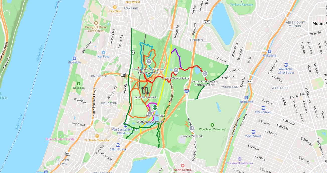
#1 · Van Cortlandt Park
0.0(0)ParkNew York City21 trails

New York, United States has 7 parks to explore on OuterMap, including Pelham Bay Park Hiking Trails, Seton Falls Park and Van Cortlandt Park. Between them they have 96 mapped trails and 86 points of interest. The cities with the most places are New York City (5), Grand Island (1) and Ithaca (1).
0.0(0)ParkNew York City21 trails
0.0(0)ParkNew York City2 trails
The Bronx River () is a river approximately 24 miles (39 km) long, flowing through southeastern New York in the United States and draining an area of 38.4 square miles (99 km2). It is named after colonial settler Jonas Bronck.
0.0(0)ParkNew York City22 trails
Seton Falls Park is a 36-acre (15 ha) wooded area in the Edenwald area of The Bronx in New York City. The park is named after the Seton family (of which Elizabeth Ann Seton was a member), who owned the land in the 19th century. Seton Falls Park is located southeast of the intersection of East 233rd Street and Baychester Avenue.
0.0(0)ParkNew York City10 trails
Ferry Point Park is a 413.8-acre (167.5 ha) park in the Bronx, New York City. The park site is a peninsula projecting into the East River roughly opposite the College Point and Malba neighborhoods of Queens. The park is located on the eastern shore of Westchester Creek, adjacent to the neighborhood of Throggs Neck. The park is operated by the New York City Department of Parks and Recreation.
0.0(0)ParkNew York City29 trails
0.0(0)ParkIthaca10 trails
Buttermilk Creek is a river located in Tompkins County, New York. It flows into Cayuga Inlet by Ithaca, New York.
0.0(0)ParkGrand Island5 trails
Buckhorn Island State Park is an 895-acre (3.62 km2) state park located in Erie County, New York in the Town of Grand Island. The park is on the northern end of the island of Grand Island.
OuterMap has 7 parks in New York, United States, including Pelham Bay Park Hiking Trails, Seton Falls Park, Van Cortlandt Park, Ferry Point Park and Buttermilk Falls State Park.
On OuterMap, the most are in New York City (5), Grand Island (1) and Ithaca (1).
Pelham Bay Park Hiking Trails has the most mapped trails in New York, with 29. Next is Seton Falls Park, with 22.
The longest mapped trail in New York is Finger Lakes / N Country Trail at Buttermilk Falls State Park, at 3.4 miles.
Ferry Point Park and Pelham Bay Park Hiking Trails have picnic areas marked on their maps.
Explore interactive maps, discover trails and points of interest, and navigate confidently with the OuterMap mobile app — with detailed information and offline access wherever you go.