
OuterMap

Parks in Eldorado Springs

Eldorado Springs, Colorado, United States has 1 park to explore on OuterMap: Eldorado Canyon State Park. It has 6 mapped trails and 23 points of interest.

Places

  1. #1 · Eldorado Canyon State Park

    0.0(0)ParkEldorado Springs6 trails

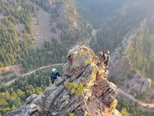
    Eldorado Canyon State Park is a renowned day-use state park known worldwide for its dramatic 1.6-billion-year-old sandstone and quartzite cliffs, making it a premier destination for rock climbers. Located along South Boulder Creek, the park offers hiking, mountain biking, picnicking, fishing, and bird watching. Popular trails include the Fowler Trail, Streamside Trail, Rattlesnake Gulch Trail (leading to the historical Crags Hotel ruins and views of the Continental Divide), and the Eldorado Canyon Trail, which connects to the Walker Ranch Loop. The park is strict day-use only with no camping, and timed vehicle entry reservations are enforced during summer weekends and holidays to manage traffic.

Frequently Asked Questions

How many parks are there in Eldorado Springs?

OuterMap has 1 park in Eldorado Springs, Colorado, United States: Eldorado Canyon State Park.

What is the longest trail in Eldorado Springs?

The longest mapped trail in Eldorado Springs is RattleSnake Gulch Trail (Multi use - Foot/Bicycle) at Eldorado Canyon State Park, at 2.5 miles.

Where can I have a picnic in Eldorado Springs?

Eldorado Canyon State Park has picnic areas marked on its map.

Which parks in Eldorado Springs have wheelchair-accessible places?

Eldorado Canyon State Park has places marked as wheelchair accessible on its map.

Download The App & Explore Anywhere

Explore interactive maps, discover trails and points of interest, and navigate confidently with the OuterMap mobile app — with detailed information and offline access wherever you go.