Indoor Mapping Software: Features, Benefits & Applications
Indoor mapping software helps organizations turn complex building layouts into interactive digital experiences that make destinations easier to find and navigate. From hospitals and airports to universities, malls, and event venues, this guide covers the key features, benefits, applications, and considerations for choosing the right indoor mapping solution.
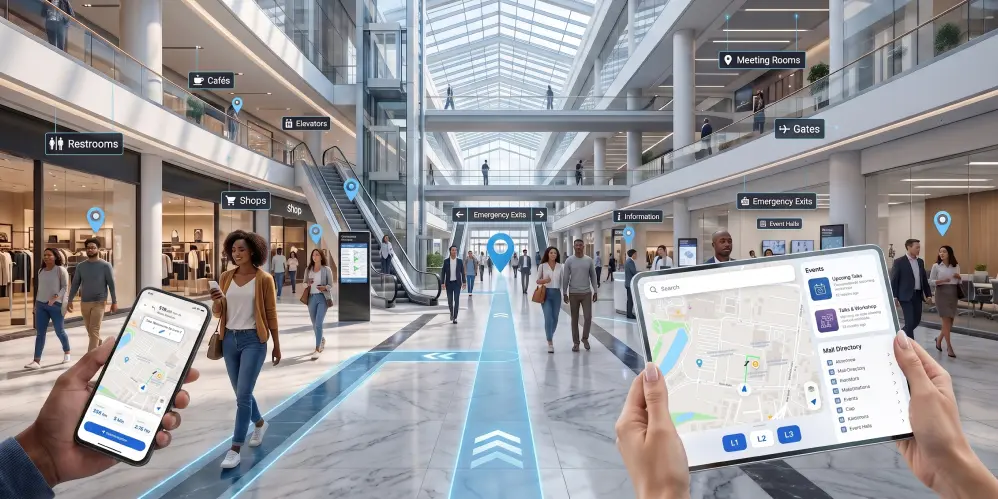
What Is Indoor Mapping Software?
Finding the right destination inside a large building can be challenging. Hospitals, airports, universities, shopping malls, museums, corporate campuses, and event venues often consist of multiple floors, hundreds of rooms, and complex layouts that traditional signs alone cannot efficiently support.
Indoor Mapping Software helps organizations transform static floor plans into interactive digital maps that make indoor spaces easier to understand and navigate. Instead of relying on printed directories or confusing signage, visitors can search for destinations, view routes, and access location information from a mobile device, kiosk, or web application.
Modern indoor mapping platforms do much more than display a map. They enable organizations to build interactive floor maps, manage points of interest (POIs), update layouts quickly, and create better navigation experiences for visitors, employees, patients, students, and guests.
Whether someone is trying to locate a hospital department, find a retail store in a shopping mall, or navigate an airport terminal, indoor mapping platform simplifies the journey while improving the overall visitor experience.
Why Indoor Maps Matter More Than Ever
People expect navigation to be simple. Outdoor navigation has become second nature through digital maps, but indoor spaces remain one of the biggest navigation challenges.
Large facilities continue to grow in size and complexity. Visitors often lose valuable time searching for departments, meeting rooms, gates, classrooms, exhibition halls, or service counters. This leads to frustration, delays, and unnecessary pressure on staff.
Interactive indoor maps solve these challenges by providing clear visual guidance inside buildings.
Organizations benefit because visitors spend less time asking for directions and more time completing their intended activities.
An effective indoor mapping solution also improves accessibility by helping users identify elevators, accessible entrances, restrooms, emergency exits, parking areas, and other important facilities.
As digital transformation continues across industries, organizations increasingly recognize indoor mapping as an essential component of visitor engagement rather than an optional feature.
How Indoor Mapping Software Works
Interactive indoor maps transform traditional building layouts into intelligent digital maps that users can explore and interact with across multiple devices.
The process generally includes the following steps.
1. Import Building Floor Plans
The first step is importing existing architectural floor plans or digital layouts.
Supported formats commonly include:
- PNG
- JPG
- SVG
These files become the foundation for creating interactive indoor maps.
2. Digitize the Floor Plan
After importing the floor plan, the map is converted into a digital format that supports interaction.
Depending on the platform, this may involve:
- Creating walkable pathways
- Defining rooms
- Mapping corridors
- Identifying entrances
- Marking elevators
- Creating multiple building levels
Modern platforms can significantly reduce the time required to digitize complex facilities.
3. Add Points of Interest
Once the map structure is complete, organizations can add searchable locations such as:
- Reception areas
- Departments
- Meeting rooms
- Shops
- Food courts
- Gates
- Parking
- Washrooms
- Emergency exits
- Customer service desks
Each location can include additional information such as descriptions, opening hours, images, contact information, and accessibility details.
4. Configure Indoor Navigation
The software connects pathways across the building to calculate routes between locations.
Visitors can search for a destination and receive clear step-by-step directions.
Navigation may include:
- Floor transitions
- Elevator routes
- Stair access
- Accessible routes
- Shortest path guidance
This functionality is typically powered by Indoor Navigation Software, which works alongside the digital map.
5. Publish Interactive Maps
After the map is complete, it can be published across multiple channels, including:
- Company websites
- Mobile applications
- Visitor information displays
- QR code links
- Digital directories
This ensures visitors can access navigation whenever and wherever they need it.
Core Features of Indoor Mapping Software
Choosing the right platform requires understanding the capabilities that create a seamless navigation experience.
The most effective indoor mapping solutions typically include the following features.
Interactive Floor Maps
Interactive floor maps allow users to zoom, search, and explore buildings instead of viewing static images.
Users can quickly locate departments, offices, stores, classrooms, meeting rooms, or service areas without relying solely on physical signage.
Intelligent Search
Search functionality helps visitors instantly locate destinations using names, room numbers, departments, categories, or points of interest.
Instead of manually scanning directories, users receive immediate search results.
Multi-Floor Navigation
Many facilities include several floors connected by elevators, stairs, escalators, or ramps.
Indoor mapping software allows users to move seamlessly between levels while maintaining accurate navigation instructions.
Point of Interest Management
Organizations can manage hundreds or even thousands of searchable locations from a centralized dashboard.
Examples include:
- Departments
- Retail stores
- Hospital clinics
- Meeting rooms
- Classrooms
- Parking areas
- Restaurants
- Emergency facilities
Updates can often be published without redesigning the entire map.
Mobile-Friendly Experience
Modern users expect navigation on smartphones.
Indoor mapping software should provide responsive experiences across:
- Android
- iPhone
- Tablets
- Web browsers
Mobile accessibility improves convenience and supports self-guided navigation.
Accessibility Support
Accessibility features help create inclusive navigation experiences.
These may include:
- Wheelchair-accessible routes
- Elevator preferences
- Accessible entrances
- Restroom locations
- Emergency exit guidance
Providing accessible navigation benefits both visitors and organizations by making facilities easier to use for everyone.
Indoor Mapping vs Indoor Navigation vs Indoor Positioning vs Indoor Wayfinding
These terms are often used interchangeably, but they refer to different components of an indoor navigation ecosystem. Understanding the differences helps organizations choose the right solution for their specific requirements.
| Technology | Purpose | Business Value |
|---|---|---|
| Indoor Mapping Software | Creates interactive digital maps of indoor spaces | Provides the foundation for navigation and visualization |
| Indoor Positioning Software | Determines a user's location inside a building | Enables real-time location awareness and location-based services |
| Indoor Navigation Software | Calculates and displays routes between locations | Guides users to their destinations efficiently |
| Indoor Wayfinding Software | Improves the overall navigation experience using maps, directions, signage, and search | Enhances visitor satisfaction and reduces confusion |
In most enterprise deployments, these technologies work together to deliver a complete indoor navigation experience.
Benefits of Indoor Mapping Software
An interactive indoor mapping platform delivers value far beyond helping visitors find their destination. It improves operational efficiency, enhances visitor experiences, and supports digital transformation across a wide range of industries.
Improve Visitor Experience
Visitors expect the same convenience indoors that they receive from outdoor navigation apps.
Interactive indoor maps help users quickly locate destinations without depending on reception staff or printed directories.
A better navigation experience leads to higher visitor satisfaction and greater confidence while exploring unfamiliar environments.
Reduce Navigation Confusion
Large facilities often have multiple entrances, corridors, departments, elevators, and floors.
Indoor mapping software minimizes confusion by providing clear visual guidance and intuitive route planning.
This reduces missed appointments, delays, and unnecessary frustration.
Save Staff Time
Employees frequently spend valuable time giving directions to visitors.
With self-service navigation available through interactive maps, staff can focus on higher-value tasks instead of repeatedly answering location-related questions.
Improve Operational Efficiency
Digital maps make it easier to manage facility information from a central location.
Organizations can quickly update:
- Office locations
- Departments
- Retail stores
- Event spaces
- Meeting rooms
- Emergency exits
- Visitor services
This ensures visitors always access current information.
Support Accessibility
Accessibility is an essential consideration for modern buildings.
Indoor mapping software helps visitors locate:
- Accessible entrances
- Elevators
- Accessible restrooms
- Ramps
- Emergency exits
Providing accessible navigation creates a better experience for all users.
Increase Visitor Engagement
Interactive maps can include detailed information such as:
- Business hours
- Contact information
- Images
- Promotions
- Events
- Nearby services
This transforms a simple navigation tool into an interactive visitor engagement platform.
Industry Applications of Indoor Mapping Software
Indoor mapping software provides value across a wide range of industries because every large facility faces the same challenge: helping people quickly and easily find the right location.
Hospitals and Healthcare Facilities
Hospitals are among the most complex indoor environments.
Patients, visitors, and healthcare professionals often need to navigate:
- Multiple buildings
- Departments
- Clinics
- Laboratories
- Pharmacies
- Parking areas
Interactive maps simplify navigation while reducing stress for patients and visitors.
Airports
Airports serve thousands of passengers every day.
Indoor navigation helps travelers locate:
- Gates
- Security checkpoints
- Check-in counters
- Lounges
- Restaurants
- Retail stores
- Baggage claim
- Transportation services
Efficient navigation improves passenger satisfaction while reducing missed connections.
Shopping Malls
Large shopping centers contain hundreds of stores spread across multiple floors.
Indoor mapping software allows visitors to:
- Search for stores
- Find restaurants
- Locate parking
- View promotions
- Navigate efficiently
Retail operators also benefit from improved customer engagement.
Universities and Campuses
Modern campuses often include dozens of buildings.
Students, faculty members, visitors, and event attendees can easily navigate:
- Classrooms
- Lecture halls
- Libraries
- Laboratories
- Administration offices
- Sports facilities
Interactive campus maps reduce confusion, particularly for new students and visitors.
Museums
Museums prioritize visitor experiences.
Indoor maps help guests explore:
- Exhibition galleries
- Interactive exhibits
- Cafés
- Gift shops
- Restrooms
- Event spaces
Visitors spend more time enjoying exhibits instead of searching for directions.
Stadiums and Arenas
Sports venues attract thousands of visitors during major events.
Indoor navigation assists fans in locating:
- Seating sections
- Food vendors
- Merchandise stores
- Parking areas
- Entrances
- Restrooms
Better navigation contributes to a smoother event experience.
Corporate Offices
Large office campuses can be difficult for employees, clients, and visitors to navigate.
Indoor mapping supports:
- Meeting room navigation
- Department directories
- Visitor guidance
- Workplace navigation
- Employee onboarding
Organizations benefit from a more efficient workplace experience.
Event Venues and Convention Centers
Trade shows, exhibitions, and conferences often cover extensive indoor spaces.
Interactive maps help attendees locate:
- Booths
- Conference rooms
- Registration desks
- Networking areas
- Food courts
- Session locations
Exhibitors also benefit from increased visitor engagement.
How to Choose the Right Indoor Mapping Software
Selecting the right platform requires evaluating both current requirements and future growth.
When comparing solutions, consider the following factors.
Ease of Map Creation
Look for software that allows teams to create and update maps without requiring extensive technical expertise.
Efficient map management reduces maintenance costs and keeps information current.
Interactive Navigation
Choose a platform that provides intuitive route guidance and accurate indoor navigation across multiple floors.
Navigation should remain simple even in large, complex facilities.
Scalability
Your mapping solution should grow with your organization.
Whether managing one building or hundreds of locations, the platform should support expansion without requiring significant redevelopment.
Mobile Compatibility
Ensure the solution works seamlessly across:
- Smartphones
- Tablets
- Desktop browsers
- Digital kiosks
A consistent experience across devices improves usability.
Integration Capabilities
Modern organizations often integrate indoor mapping with:
- Facility management systems
- Visitor management platforms
- Event management software
- Mobile applications
- Building information systems
Integration helps create a connected digital ecosystem.
Custom Branding
Organizations should be able to customize maps with their own:
- Colors
- Logos
- Icons
- Branding
- User interface elements
White-label capabilities are particularly valuable for enterprises.
The Future of Indoor Mapping Software
As buildings become smarter and more connected, indoor mapping continues to evolve.
Emerging trends include:
- AI-assisted map creation
- Automated map digitization
- Smarter route optimization
- Improved accessibility features
- Enhanced mobile experiences
- Digital twin integration
- Location intelligence
- Personalized navigation experiences
Organizations investing in modern indoor mapping platforms today will be better prepared for the future of smart buildings and connected visitor experiences.
Why Businesses Choose OuterMap
Organizations require more than a static floor plan. They need an interactive platform that simplifies navigation, improves visitor experiences, and supports efficient facility management.
OuterMap enables organizations to create interactive indoor maps that help visitors navigate complex spaces with confidence. From hospitals and airports to universities, shopping malls, museums, stadiums, corporate campuses, and event venues, interactive mapping can improve accessibility, reduce navigation challenges, and enhance the overall visitor journey.
By combining digital mapping with intuitive navigation capabilities, organizations can deliver a modern experience that benefits visitors, employees, and facility managers alike.
Frequently asked questions
1. What is indoor mapping software?
Indoor mapping software is a digital solution that converts building floor plans into interactive maps. It allows users to search locations, explore indoor spaces, and navigate complex buildings such as hospitals, airports, shopping malls, universities, offices, museums, and stadiums.
2. How Does Indoor Mapping Work?
An interactive indoor mapping platform imports floor plans, digitizes building layouts, creates searchable points of interest (POIs), and transforms them into interactive digital maps. When integrated with indoor navigation capabilities, users can quickly search for destinations and receive optimized routes throughout the building.
3. What is the difference between indoor mapping software and indoor navigation software?
Indoor mapping software focuses on creating and managing interactive digital maps, while indoor navigation software provides route guidance between locations. Indoor mapping builds the visual foundation, whereas indoor navigation helps users move efficiently from one point to another.
4. What is indoor positioning software?
Indoor positioning software determines a user's location inside a building where GPS signals are unreliable or unavailable. It can use technologies such as Bluetooth Low Energy (BLE), Wi-Fi, Ultra-Wideband (UWB), RFID, or visual positioning to provide accurate indoor location information.
5. Which industries benefit from indoor mapping software?
Indoor mapping software is widely used across industries, including: Hospitals and healthcare facilities Airports Shopping malls Universities and campuses Museums Stadiums and arenas Corporate offices Event venues Convention centers Government buildings Any organization that manages large indoor spaces can benefit from interactive maps and navigation.
6. Can Interactive Indoor Maps Improve Accessibility?
Yes. Interactive indoor maps help visitors identify wheelchair-accessible routes, elevators, ramps, accessible entrances, restrooms, and emergency exits. By providing clear and accessible navigation, they create a more inclusive, user-friendly experience for everyone.
7. Is an Interactive Indoor Mapping Platform Suitable for Multi-Building Campuses?
Yes. Modern interactive indoor mapping platforms can manage multiple buildings, multiple floors, and large campuses from a centralized interface. This makes them an ideal solution for universities, healthcare campuses, corporate offices, airports, industrial facilities, and other large-scale environments.
8. Why should businesses invest in indoor mapping software?
Businesses invest in indoor mapping software to improve visitor experiences, reduce navigation confusion, save staff time, simplify facility management, increase operational efficiency, and support digital transformation initiatives.
Conclusion
Modern buildings continue to grow in size and complexity, making intuitive indoor navigation more important than ever. Whether visitors are arriving at a hospital, shopping mall, airport, university, museum, or corporate campus, they expect the same seamless navigation experience they receive outdoors.
Indoor mapping platform provides the digital foundation for creating interactive floor maps, while indoor positioning software, indoor navigation software, and indoor wayfinding software work together to guide visitors efficiently through indoor environments.
Organizations that invest in interactive indoor mapping can improve visitor satisfaction, streamline operations, reduce navigation-related challenges, and create more accessible spaces.
As digital transformation continues across industries, interactive indoor maps are becoming an essential part of delivering exceptional visitor experiences rather than simply a convenience.
Ready to Transform Your Indoor Spaces?
If your organization wants to simplify indoor navigation, improve visitor experiences, and create interactive digital maps, OuterMap provides a modern platform designed to help businesses build intuitive indoor mapping solutions.
Whether you're managing a hospital, airport, university, shopping mall, museum, stadium, office, or event venue, interactive indoor maps can help visitors find their destinations faster while supporting a more connected digital experience.