Fall Foliage Season: How Parks Can Guide Visitors to the Best Viewpoints Without the Crowds
Fall foliage season brings visitors to parks to enjoy colorful leaves, scenic landscapes, and outdoor activities. Popular viewpoints and well-known trails can attract many people at the same time, making it harder for visitors to enjoy the scenery and for park teams to manage busy areas.
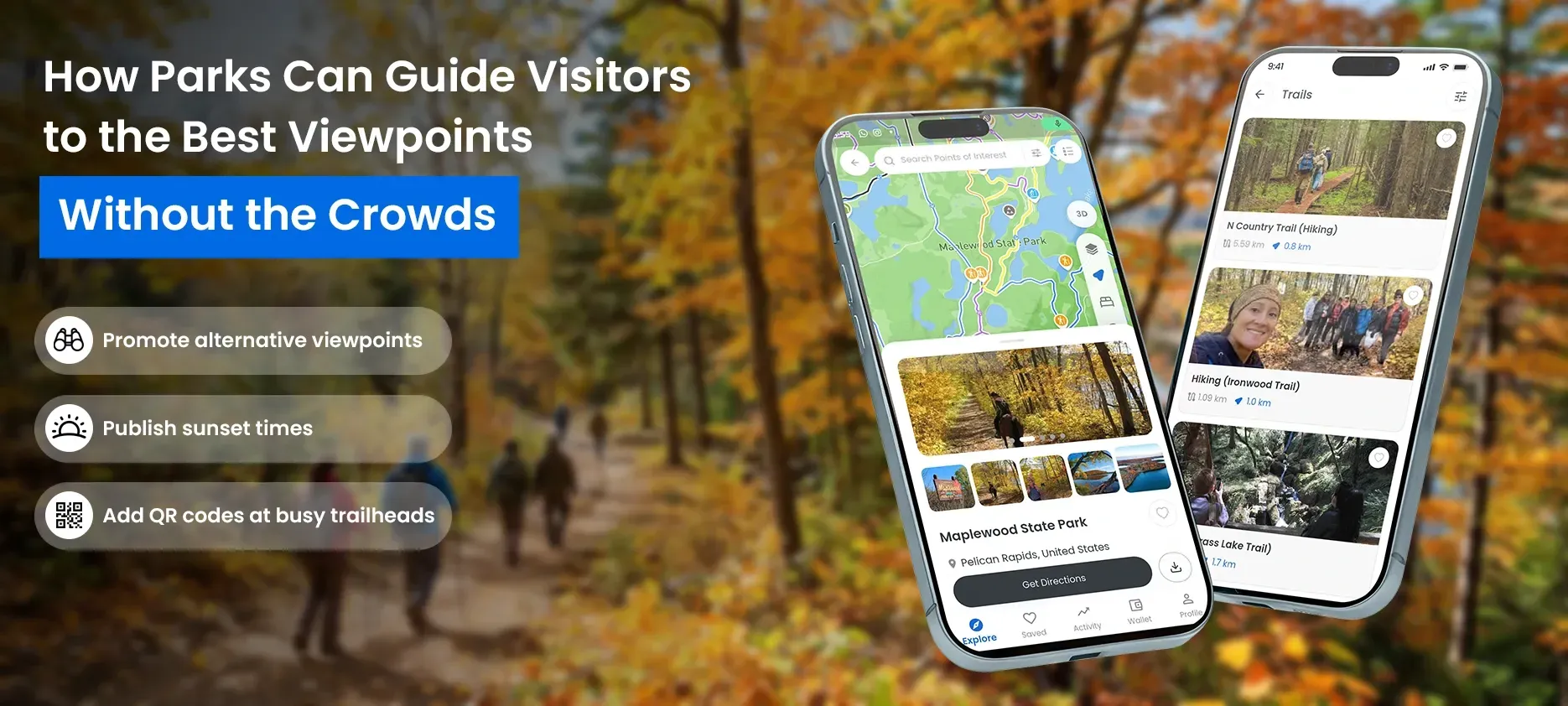
For park managers and recreation departments, the goal is not simply to attract more visitors. It is to help people plan their visits, discover different places to explore, and find useful information before and during their time in the park.
Digital maps, viewpoint information, alternative trails, and timely visitor updates can all support this effort. By reviewing available visitor-engagement data after the season, parks can also identify opportunities to improve their guidance for the following fall.
Quick Wins for This Fall Foliage Season
Parks can take these practical steps during the current fall foliage season to help visitors explore scenic locations and plan their visits more effectively.
- Promote alternative viewpoints: Highlight two or three suitable, less-busy viewpoints that are open to visitors, giving people more options beyond the most popular locations.
- Publish sunset times: Share accurate local sunset times on park information pages or digital maps so visitors can plan their outings and allow enough time to return before dark.
- Add QR codes at busy trailheads: Place QR codes at suitable trailheads so visitors can quickly open park maps on their phones and find mapped trails, viewpoints, and facilities.
Keep all information accurate and up to date, especially trail access, closures, and safety guidance.
Why Fall Foliage Season Can Be Challenging for Parks
During peak foliage periods, many visitors want to see the same famous overlooks, lakes, forest trails, and scenic routes. When too many people head toward the same locations, parking areas and trail access points may become busy, and popular viewpoints can feel crowded.
These conditions can create challenges for park teams, including:
- Crowded viewpoints: Visitors may have limited space to enjoy the scenery or take photographs.
- Busy trails and access points: Popular routes can experience increased foot traffic during peak periods.
- Visitor confusion: People unfamiliar with the park may struggle to find viewpoints, trail entrances, restrooms, and other points of interest.
- Last-minute planning: Visitors may arrive without checking trail conditions, sunset times, weather, or access restrictions.
- Limited planning insights: Without reviewing available visitor information, it can be difficult to understand which locations attracted attention and where clearer guidance may be needed next year.
Not every busy period can be avoided. However, parks can make it easier for visitors to explore responsibly by providing clear, timely, and accessible information.
1. Create Digital Pages for Popular Fall Viewpoints
Visitors often begin planning their trips by searching for the best places to see fall colors. Parks can help them make informed choices by creating dedicated digital pages for notable viewpoints and scenic locations.
Each viewpoint page should provide practical information that helps visitors decide whether a location suits their visit.
Consider including:
- Location and directions: Explain where the viewpoint is and how visitors can reach it.
- Nearby trails: Identify walking routes or other mapped locations in the surrounding area.
- Viewing information: Describe the scenery visitors can expect, using accurate and up-to-date information.
- Accessibility details: Share confirmed information about step-free access, route conditions, or other relevant accessibility features.
- Facilities and restrictions: Include available information about parking, restrooms, opening hours, closures, or access rules.
- Current updates: Link to official park announcements when conditions or access arrangements change.
An interactive outdoor map can connect these details with the wider park layout. Visitors can see where a viewpoint is located, explore nearby points of interest, and plan a route before setting out.
Clear viewpoint information also helps visitors understand their options rather than assuming that the most widely promoted location is their only choice.
2. Promote Alternative Trails and Viewpoints
One way to help manage pressure on popular locations is to introduce visitors to other suitable places within the park.
A famous overlook may attract many visitors, while other mapped viewpoints and trails offer different scenery and outdoor experiences. Parks can use digital maps and visitor information to make these alternatives easier to discover and help visitors choose locations that suit their interests, abilities, and available time.
OuterMap's existing park-mapping work provides a real-world example. Its digital map experiences include Gooseberry Falls State Park and Itasca State Park in Minnesota, bringing trails, attractions, facilities, and other points of interest together in one digital experience. Read the guide to Minnesota state park maps to learn more about how OuterMap supports park exploration.
For example, a park might:
- Highlight additional scenic viewpoints that are open and suitable for visitors.
- Suggest alternative trails based on distance, terrain, and verified route information.
- Show connections between trails, viewpoints, facilities, and nearby points of interest.
- Explain the differences between short walks, longer hikes, and routes with more challenging terrain.
- Update visitor information when trails close or access restrictions change.
The goal is not to direct everyone to a single alternative location, as this could simply shift congestion elsewhere. Instead, parks can present several suitable options and help visitors make informed choices based on their interests, abilities, available time, and current park conditions.
All recommendations should be based on accurate, up-to-date information. Parks should not promote a trail or viewpoint as an alternative if it is closed, unsafe, unsuitable for the intended visitors, or subject to access restrictions.
3. Share Weather, Sunset, and Fall-Color Information
Useful planning information can help visitors choose when and where to explore. During fall foliage season, weather, daylight, and changing leaf colors can influence the experience.
Parks can bring relevant information together on their websites, viewpoint pages, or digital maps.
Weather information
Link to a reliable weather source or share verified updates from the park. Visitors may want to check temperatures, rainfall, wind, and other conditions before choosing a trail. Explain that conditions can change and encourage visitors to check updates before departure.
Sunset times and daylight
Visitors planning an evening walk or scenic photography trip need to know when daylight will end. Sharing local sunset times and guidance about the time required to complete a route can help visitors plan more carefully.
Parks should remind visitors to allow enough time to return before dark and to carry suitable lighting when appropriate for the route and park rules.
Fall-color updates
Where reliable updates are available, parks can share information about foliage conditions in different areas. Leaf colors change with weather, elevation, tree species, and seasonal timing, so avoid promising that a viewpoint will have peak color on a particular date unless the information is verified and appropriately qualified.
Trail and access updates
Weather and seasonal conditions may affect trail surfaces, parking, access, and facilities. Link to official park notices so visitors can check current restrictions before traveling.
OuterMap does not need to generate weather forecasts or fall-color predictions for parks to provide this information through their visitor-planning experience. Parks can link to their own updates and suitable external sources alongside their mapped viewpoints and trails.
4. Make Park Maps Easy to Access Before and During a Visit
Visitors may discover a park through its website, social media, a search result, or an information board at the entrance. Parks can make the planning process easier by providing a clear way to access their maps from these different starting points.
Interactive outdoor maps can show mapped trails, viewpoints, and points of interest in one place. Visitors can explore the layout, identify locations, and use available navigation features to understand how to reach their chosen destinations.
QR codes can provide a convenient entry point. A park can place them on signs, visitor information materials, or other suitable locations so visitors can open the map on their phones.
Live GPS location and navigation can help visitors understand where they are in relation to mapped locations and routes. Offline map access is also useful in areas where mobile connectivity is limited, provided the relevant map has been made available offline in advance.
When choosing how to present park information, managers should consider whether visitors can easily:
- Find and open the map.
- Identify their current location when GPS is available.
- Locate viewpoints, trails, and facilities.
- Understand route details and access restrictions.
- Access relevant map information when connectivity is limited.
A map should support good decision-making, not replace official signs, safety instructions, park staff guidance, or emergency procedures.
5. Share Known Peak Periods and Alternative Viewpoints
During fall foliage season, some viewpoints, trails, and parking areas may become busier than others. Parks can help visitors plan ahead by sharing known peak visiting periods, current access information, and suitable alternatives.
Rather than relying on unverified real-time crowd estimates, park teams can use their local knowledge and available visitor information to provide practical guidance.
For example, parks can:
- Share information about times when popular viewpoints or trails are typically busy, where reliable information is available.
- Highlight several alternative viewpoints and trails that are open and suitable for visitors.
- Link to current parking, trail access, and closure notices.
- Encourage visitors to consider different locations or visiting times when planning their trips.
Digital maps can help present these alternatives alongside mapped trails, viewpoints, and facilities, making it easier for visitors to explore their options.
Parks should keep recommendations accurate and update them when conditions change. While clear information can help visitors make informed choices, it cannot guarantee that crowds will be avoided or eliminated.
6. Review Visitor-Engagement Data After the Season
Fall foliage season can also help parks understand how people interact with their visitor information.
Rather than relying only on assumptions about popular locations, park teams can review available data after the season to identify areas for improvement.
Depending on the analytics available, useful questions may include:
- Which mapped locations received the most attention?
- Which trails or viewpoints did visitors explore through the digital map?
- Which areas might need clearer directions or more detailed information?
- Did visitors engage with alternative viewpoints and routes?
- Which map pages or visitor updates could be improved before next fall?
OuterMap provides an analytics dashboard for reviewing available navigation and visitor-engagement information. The precise insights depend on the data collected and the analytics configured for the park.
It is important to distinguish engagement data from actual visitor counts. For example, activity recorded through a digital map does not necessarily represent every person who visited a location. Parks should combine digital insights with other reliable information, where available, before making operational decisions.
Turn this year's insights into next year's plan
After the season, park teams can use their findings to prepare for the following year.
Review: Identify which locations, routes, and information received attention.
Improve: Update viewpoint descriptions, directions, trail details, and visitor guidance where needed.
Prepare: Check seasonal access information, confirm external weather and sunset resources, and plan communications for expected busy periods.
Publish: Make the revised information available before the next foliage season so visitors have time to plan.
This process helps parks build on what they learn each year instead of starting their seasonal planning from scratch.
How OuterMap Can Support Fall Foliage Visitor Planning
OuterMap helps parks present outdoor locations and navigation information through interactive digital maps. During fall foliage season, these maps can help visitors discover scenic viewpoints, explore trails, locate facilities, and plan their time outdoors.
Depending on the park's mapped content and enabled features, OuterMap can support:
- Viewpoint details: Help visitors discover scenic viewpoints and access relevant location information.
- Popular trails: Help visitors explore mapped trails and review available route information.
- Amenities and facilities: Show mapped facilities such as parking areas, restrooms, and picnic areas, where available.
- Route and itinerary planning: Help visitors explore mapped locations and routes to plan their park visits, depending on the available planning features.
- Nearby events and activities: Help parks share information about activities such as guided fall-color walks, where event information can be added or linked.
- Restricted areas and trail closures: Help visitors identify restricted areas and closed trails through supported map features and verified updates.
- GPS navigation: Help visitors orient themselves and navigate to mapped destinations.
- Offline map access: Let visitors access available map information without a continuous internet connection.
- QR code access: Give visitors a convenient way to open park maps from signs and visitor information materials.
- Analytics dashboard: Help park teams review available navigation and visitor-engagement data.
Parks can complement their maps with verified seasonal announcements and links to reliable information about weather, sunset times, trail conditions, and fall-color updates.
By bringing mapped locations and relevant visitor information together, OuterMap can support a more informed park-planning experience. Accurate content, timely updates, and clear safety guidance remain essential throughout the fall foliage season.
Frequently Asked Questions
1. How can parks help reduce crowds at popular fall foliage viewpoints?
Parks can publish clear viewpoint information, promote several suitable alternative trails, share current access updates, and provide reliable crowd information where available. These steps can help visitors make more informed choices, although they cannot guarantee that congestion will be eliminated.
2. How can digital maps help visitors explore fall foliage locations?
Interactive maps can show mapped viewpoints, trails, and points of interest, helping visitors understand where locations are and how they connect. GPS navigation, QR code access, and offline maps can further support visitors when these features are available and configured for the park.
3. What information should parks share before fall foliage season?
Useful information includes viewpoint locations, trail distances and conditions, access restrictions, available facilities, weather resources, sunset times, accessibility details, and seasonal updates. Information should be accurate, easy to find, and updated when conditions change.
4. Can visitor-engagement analytics help parks plan for next fall?
Yes. Available analytics can help park teams understand how visitors interact with digital maps and which mapped locations receive attention. However, digital engagement does not automatically represent total park attendance or actual visitor counts, so teams should interpret it alongside other reliable information.
5. When should parks publish fall viewpoint information?
Parks should publish fall viewpoint information before the foliage season begins and update it throughout the season as conditions change. Information about scenic viewpoints, alternative trails, access routes, and known peak visiting times can help visitors plan their trips more effectively. Digital maps can make this information easier to find before and during a visit.
Help Visitors Plan Better for Fall Foliage Season
Fall foliage season gives parks an opportunity to improve how they share information and guide visitors through outdoor spaces.
By highlighting scenic viewpoints, suggesting suitable alternative trails, sharing reliable planning updates, and reviewing available visitor-engagement data, park teams can make better-informed decisions for the current and following seasons.
OuterMap supports these efforts with interactive outdoor maps, navigation, offline access, QR codes, and analytics capabilities, helping parks bring mapped locations and visitor information together.
Explore Park Trails and Viewpoints with the OuterMap Web App
Explore park trails and viewpoints through the OuterMap web app, with no download required. Visitors can use the web app to explore mapped locations, while the OuterMap mobile app offers GPS navigation, offline maps, and SOS alerts.