Making Minnesota State Parks Easier to Explore With Digital Maps
Minnesota’s state parks offer diverse landscapes, trails, facilities, and attractions that can be difficult to explore using static maps alone. Digital maps can connect these locations in one mobile experience, helping visitors discover destinations, plan routes, and access useful information while exploring.
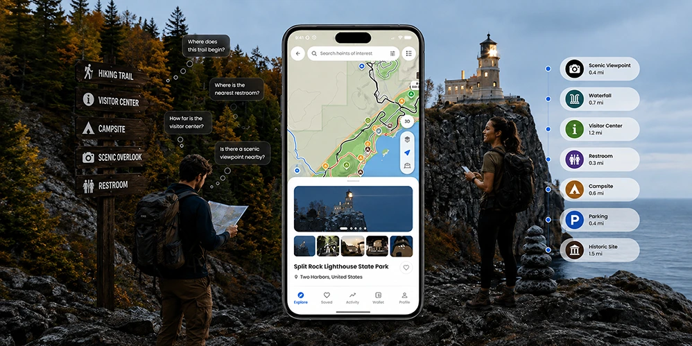
Minnesota's state parks offer visitors an incredible variety of outdoor experiences, from the forests and waterways of northern Minnesota to the rugged North Shore, prairie landscapes, waterfalls, scenic overlooks, and historic sites.
With more than 11 million visitors to Minnesota state parks each year, providing visitors with convenient access to maps and location-based information is increasingly important. A Minnesota state park map can help visitors understand where trails, facilities, attractions, and other points of interest are located before and during their visit.
But exploring an unfamiliar park can raise simple questions:
- Where does this trail begin?
- Which route should I take?
- Where is the nearest restroom?
- Where is the visitor center?
- What attractions are nearby?
- Can I access the map if cellular service is limited?
- Are there activities or events happening nearby?
A digital map can help answer these questions while giving visitors a more connected way to explore.
OuterMap brings interactive maps, trail navigation, offline access, points of interest, amenities, activities, safety information, and community features into a mobile experience designed to help visitors explore outdoor destinations with greater confidence.
Explore Eight Minnesota State Parks With OuterMap
OuterMap currently provides digital map experiences for eight Minnesota state parks:
- Itasca State Park
- Tettegouche State Park
- Interstate State Park
- Frontenac State Park
- Blue Mounds State Park
- Split Rock Lighthouse State Park
- Jay Cooke State Park
- Gooseberry Falls State Park
These parks represent very different landscapes and visitor experiences.
Some visitors may be looking for hiking trails. Others may want scenic viewpoints, waterfalls, historic attractions, facilities, activities, or an easier way to understand the area around them.
That is where an interactive Minnesota state park map can provide value.
Instead of simply showing where a trail is located, a digital map can connect trails with facilities, attractions, activities, and other relevant points of interest.
Why Digital Maps Can Improve the State Park Experience
A printed map can provide valuable information, but digital mapping can make that information more interactive and easier to access while visitors are exploring.
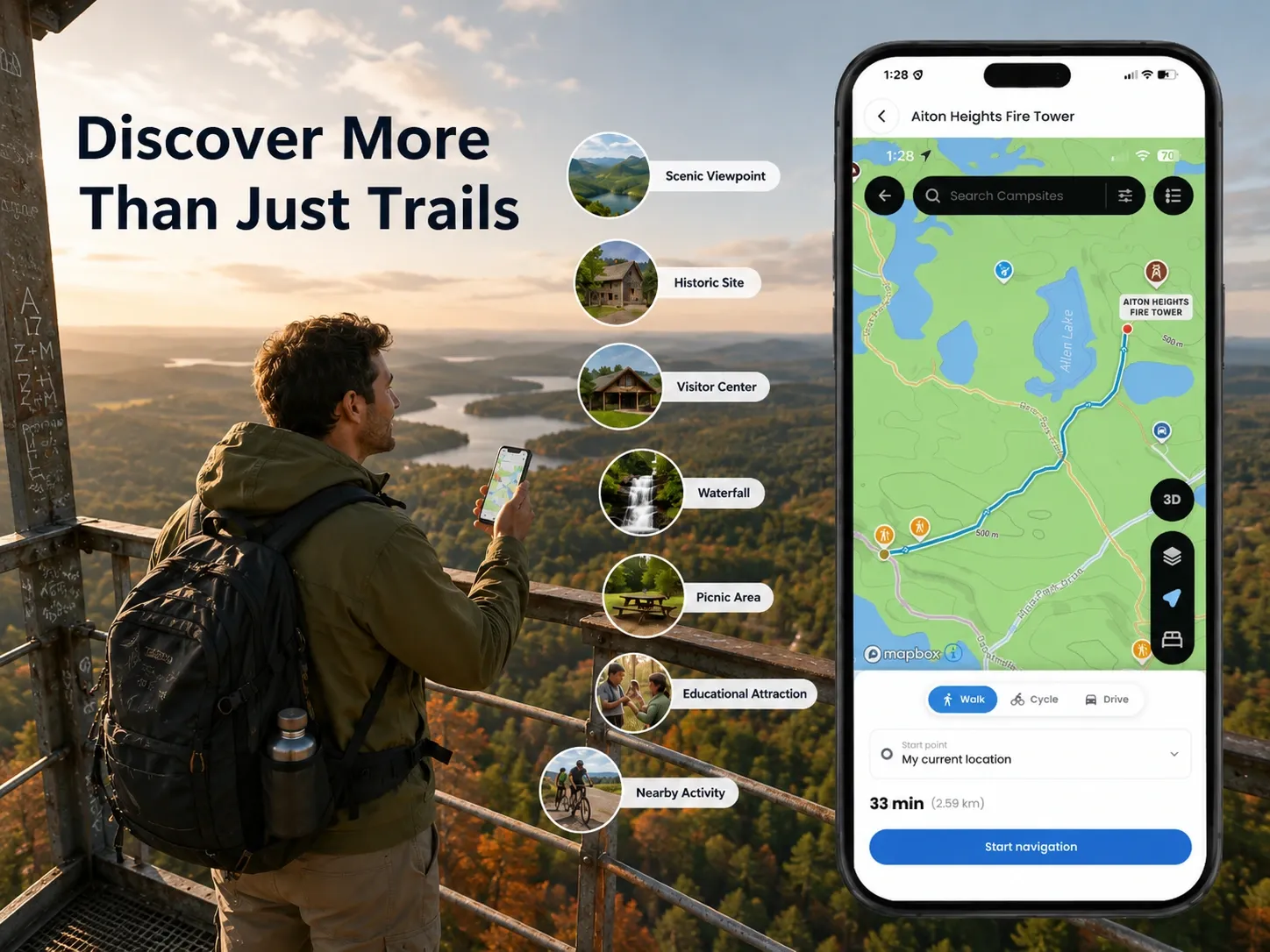
With OuterMap, visitors can use the digital experience to:
- Explore mapped trails
- Navigate toward selected destinations
- Find nearby amenities
- Discover points of interest
- Access offline map information
- Find activities and local happenings
- View configured safety information
- Access relevant booking links where available
- Share comments and images through community features
The goal is not to replace official park information, signage, regulations, or responsible outdoor preparation.
Instead, digital mapping can provide another convenient layer of information that helps visitors understand and navigate their surroundings.
Explore Minnesota State Park Trails With Interactive Maps
One of the most useful applications of a digital park map is helping visitors understand the trail network around them.
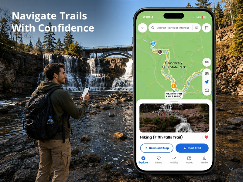
Visitors may use an interactive map to identify trail routes, trailheads, nearby facilities, attractions, and other mapped destinations.
For people researching Minnesota hiking trails, having trails displayed alongside nearby points of interest can make it easier to plan how they want to explore a park.
Instead of repeatedly checking a printed map or trying to determine their location, visitors can use a digital experience to better understand where they are and where they want to go.
This can make exploring an unfamiliar park feel more straightforward and connected.
Minnesota State Park Maps Available Through OuterMap
1. Itasca State Park Map and Trails
Itasca State Park is one of Minnesota's most distinctive outdoor destinations and is known for its connection to the headwaters of the Mississippi River.
Visitors can explore forests, waterways, trails, and other outdoor attractions throughout the park.
An Itasca State Park map can help visitors understand the park's layout and identify relevant trails, destinations, and points of interest.
OuterMap provides a digital experience where visitors can explore mapped locations and access relevant trail and destination information.
For visitors interested in Itasca State Park trails, an interactive map can provide useful context for understanding routes and nearby locations before and during exploration.
2. Tettegouche State Park Map
Located along Minnesota's North Shore, Tettegouche State Park offers rugged terrain, Lake Superior scenery, waterfalls, overlooks, forests, and hiking opportunities.
A Tettegouche State Park map can help visitors understand the relationship between trails, scenic locations, facilities, and other points of interest.
Instead of viewing individual attractions separately, visitors can explore them within a connected digital experience.
This can be particularly useful for visitors who want to combine hiking with scenic viewpoints, waterfalls, and other experiences during their visit.
3. Interstate State Park Map and Hiking Trails
Located along the St. Croix River, Interstate State Park provides visitors with river scenery, geological features, hiking opportunities, and other outdoor experiences.
An Interstate State Park map can help visitors understand where different destinations are located within the park.
For visitors researching Interstate State Park hiking trails, a digital map can provide additional context by showing trail routes alongside nearby points of interest and facilities.
OuterMap brings these mapped destinations together within the same digital experience, helping visitors explore the park with greater awareness of their surroundings.
4. Frontenac State Park Map and Trails
Situated along Lake Pepin, Frontenac State Park offers scenic overlooks, hiking opportunities, wildlife viewing, and views across the lake landscape.
A Frontenac State Park map can help visitors understand the park's layout and identify relevant destinations.
Information about Frontenac State Park trails becomes even more useful when visitors can view trail routes in relation to overlooks, facilities, and other points of interest.
With OuterMap, visitors can explore these mapped locations through an interactive digital experience rather than relying only on a static map.
5. Blue Mounds State Park Map
Blue Mounds State Park offers a distinctly different Minnesota landscape, with prairie scenery and quartzite formations.
For visitors exploring this environment, a Blue Mounds State Park map can help provide a clearer understanding of trails, destinations, and other mapped locations.
OuterMap provides an interactive way for visitors to explore configured park information and discover relevant locations as they move through the destination.
This can help visitors experience more of the park rather than focusing only on a single trail or attraction.
6. Split Rock Lighthouse State Park Map
Split Rock Lighthouse State Park combines Lake Superior shoreline scenery, hiking opportunities, scenic overlooks, and the historic lighthouse area.
A Split Rock Lighthouse State Park map can help visitors understand where trails, viewpoints, facilities, and attractions are located.
For visitors exploring Minnesota's North Shore, having these destinations available through a connected digital map can make it easier to plan where to go and discover what is nearby.
The digital experience can help connect hiking routes with other attractions instead of treating each destination as a separate part of the visit.
7. Jay Cooke State Park Map and Trails
Known for its rugged terrain and St. Louis River landscape, Jay Cooke State Park provides extensive opportunities for hiking and outdoor exploration.
A Jay Cooke State Park map can help visitors understand the relationship between trails, river landscapes, facilities, and other destinations.
Visitors researching Jay Cooke State Park trails can use a digital map to better understand available routes and what they may encounter around them.
OuterMap brings mapped trails and points of interest together so visitors can explore the park through a more connected digital experience.
8. Gooseberry Falls State Park Map
Gooseberry Falls State Park is one of Minnesota's best-known North Shore destinations, combining waterfalls, hiking trails, Lake Superior scenery, and visitor facilities.
A Gooseberry Falls State Park map can help visitors understand how trails, waterfalls, facilities, and other points of interest connect throughout the park.
For visitors planning their trip, an interactive map can make it easier to identify nearby destinations and decide what they want to explore.
OuterMap provides a digital experience that brings these mapped locations together, allowing visitors to discover more while navigating the park.
More Than a Trail Map: Discover What's Around You
A useful digital park experience should not stop at trail navigation.
Visitors may also want to find:
- Restrooms
- Parking areas
- Visitor centers
- Picnic areas
- Scenic viewpoints
- Waterfalls
- Historic attractions
- Educational locations
- Other amenities
OuterMap can bring these destinations into the same digital experience.
For example, a visitor following a trail may discover a nearby viewpoint, facility, attraction, or activity and decide to include it in their visit.
This turns the map from a simple navigation tool into a broader destination discovery experience.
Offline Maps for Areas With Limited Connectivity
Outdoor destinations do not always have consistent cellular connectivity.
Visitors may encounter areas where mobile service is weak or unavailable, particularly when exploring larger or more remote trail networks.
Offline map access can therefore be valuable for outdoor recreation.
OuterMap supports offline maps, allowing visitors to continue accessing relevant map information when connectivity is limited.
The benefit is simple:
A weak cellular signal does not have to become a navigation obstacle.
Visitors should still prepare appropriately for outdoor conditions and follow official park guidance, but offline digital access can provide another useful layer of convenience during exploration.
Find Activities and Local Happenings
A state park visit is not always only about hiking.
Depending on the destination and available information, visitors may also be interested in:
- Educational programs
- Naturalist activities
- Family activities
- Seasonal events
- Local happenings
- Other recreational experiences
OuterMap can surface configured activities and local happenings within the digital map experience.
Where an activity includes a booking or registration link, visitors can move from discovery to the relevant booking page.
This creates a simple visitor journey:
Discover → Explore → Book → Participate
Instead of treating activities as something separate from navigation, digital mapping can make them part of the overall visitor experience.
Access Safety Information While Exploring
Outdoor environments can involve changing weather, uneven terrain, water, steep areas, and other conditions that require appropriate preparation.
Digital maps can provide another way to make configured safety information easier to access.
OuterMap can support configured risk zones and restricted areas within the digital map experience.
It also includes SOS functionality as an additional safety feature.
These features should not be considered a replacement for official regulations, park signage, emergency procedures, ranger guidance, or responsible outdoor preparation.
Instead, they provide another digital layer that can help visitors access relevant information while exploring.
Community Insights Add Another Layer of Discovery
Outdoor destinations are also places where people share experiences.
Visitors may discover a scenic viewpoint, photograph a waterfall, comment on a destination, or share an interesting location with others.
OuterMap can support community comments and image contributions, creating an additional layer of visitor-generated information.
This can help turn a digital map into more than a collection of official locations.
Over time, community contributions can help future visitors discover experiences that they might otherwise overlook.
Helping Park Teams Understand Visitor Engagement
Digital mapping can also provide value beyond the visitor experience.
OuterMap provides a visitor analytics dashboard designed to give park management teams greater visibility into visitor engagement around configured trails, points of interest, amenities, attractions, and other mapped destinations.
GPS-based engagement and traffic data can provide insights into how visitors interact with different locations.
For example, park teams may be able to better understand:
- Which mapped destinations receive significant engagement
- Which amenities attract visitor activity
- Which areas receive higher levels of traffic
- Which trails or attractions receive comparatively less engagement
These insights can become one input into future planning, visitor services, maintenance priorities, and investment discussions.
The objective is not simply to collect data.
It is to make visitor engagement information more useful for understanding how a destination is being experienced.
From Visitor Data to Future Park Planning
As digital visitor analytics evolve, they may provide additional insights into how visitors interact with outdoor destinations. Depending on the data available and how it is configured, future applications could include visitor flow analysis, trail utilization insights, facility usage trends, peak visitor periods, and congestion identification.
These insights could become another input for park teams when considering visitor services, operational planning, maintenance priorities, and long-term destination management. They should complement official park information, on-the-ground knowledge, and established planning processes.
Supporting Park and Ranger Awareness
Digital visitor information can also provide an additional layer of operational awareness when appropriately configured. Park teams may configure specific risk zones or restricted areas within the digital map experience, helping communicate relevant location-based information to visitors.
Where management notification workflows are configured, activity within designated areas may also provide an additional signal for park teams to review. Any response should follow the park's established procedures and be assessed by the appropriate personnel.
These capabilities are intended to complement, not replace, official signage, park regulations, emergency systems, ranger procedures, or other established safety practices.
One Digital Experience Across Eight Minnesota State Parks
The eight OuterMap destinations demonstrate how a digital park map can support different types of outdoor experiences across Minnesota. Each destination offers its own combination of trails, natural features, attractions, facilities, and scenic locations.
From North Shore landscapes and Lake Superior scenery to river environments, prairie landscapes, lake views, waterfalls, and historic destinations, the parks represent a wide range of outdoor experiences.
Together, these destinations show how an interactive Minnesota state park map can go beyond displaying a trail line by helping visitors discover, navigate, understand, and engage with the destinations around them.
A Connected Experience for Visitors and Park Teams
Digital mapping can connect different parts of the visitor and park management experience within one platform.
For visitors, OuterMap can bring together interactive maps, trail navigation, offline access, points of interest, amenities, activities, configured safety information, and community features.
For park management teams, configured analytics and location-based insights can provide additional visibility into visitor engagement around mapped trails, facilities, attractions, and other destinations.
Together, these capabilities can support a more connected experience: better information for visitors and greater visibility for park teams.
Explore Minnesota State Parks With OuterMap
Minnesota's state parks already provide visitors with official maps, resources, regulations, safety guidance, and other park information.
OuterMap adds another digital layer by bringing navigation, discovery, offline access, activities, safety-related features, community insights, and visitor analytics into a connected experience.
Whether someone is searching for Minnesota state park maps, planning a hike, looking for a specific park map, or exploring nearby attractions, a digital map can make the experience easier to understand and navigate.
Less time figuring out where to go. More time exploring Minnesota's outdoors.
Frequently Asked Questions
What is a Minnesota state park map?
A Minnesota state park map provides geographic information that helps visitors understand park trails, facilities, attractions, and other destinations. Digital maps can add interactive navigation and additional visitor information.
Which Minnesota state parks are available on OuterMap?
OuterMap currently provides digital experiences for eight Minnesota state parks: Itasca State Park, Tettegouche State Park, Interstate State Park, Frontenac State Park, Blue Mounds State Park, Split Rock Lighthouse State Park, Jay Cooke State Park, and Gooseberry Falls State Park.
Can I use OuterMap when cellular service is limited?
OuterMap supports offline maps, which can be useful when visitors are exploring areas where cellular connectivity varies.
Can OuterMap help me explore Minnesota hiking trails?
Yes. OuterMap provides interactive digital maps that can help visitors explore configured trail networks, destinations, and points of interest.
Can I find facilities on an OuterMap park map?
Depending on the information configured for a particular park, visitors can discover locations such as restrooms, visitor centers, parking areas, trailheads, picnic areas, attractions, and other amenities.
Can I find activities and events on the map?
Where activities and local happenings are configured in the experience, visitors can discover them through the digital map. Relevant booking or registration links may also be available where applicable.
Does OuterMap provide safety features?
OuterMap can provide configured risk-zone information and SOS functionality as additional safety-related features. Visitors should always follow official park guidance, signage, regulations, and emergency procedures.
How does OuterMap help park management teams?
OuterMap provides a visitor analytics dashboard that can provide insights into engagement and traffic around configured trails, points of interest, amenities, attractions, and other mapped destinations.
Does scanning the QR code itself track visitor traffic?
The QR code primarily serves as an access point to the relevant OuterMap park experience. Visitor engagement and traffic insights are generated through the platform's configured analytics capabilities rather than simply from scanning the QR code.
Can OuterMap support ranger awareness?
Configured risk or restricted zones can be connected to management notification workflows, helping park teams become aware of activity in designated areas and assess whether a response is appropriate.
Official Minnesota State Park Information
OuterMap is intended to complement — not replace — official park information.
For current information about park regulations, closures, reservations, safety guidance, accessibility, and park-specific requirements, visitors should consult the Minnesota Department of Natural Resources (DNR) and the relevant official park resources.
Official resource: Minnesota DNR State Parks and Recreation Areas