How Digital Wayfinding Can Improve the Park Visitor Experience
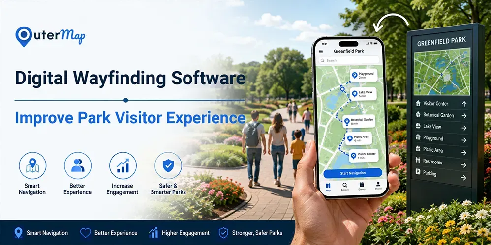
Navigating a large park can be challenging when visitors need to find trails, attractions, facilities, or other destinations. Digital wayfinding adds an interactive layer to traditional park maps and signage, helping visitors search for locations, explore routes, and access useful information from their devices.
Introduction
Navigating a large park can be challenging when visitors need to find trails, attractions, parking, restrooms, or other facilities. Traditional signs and printed maps are useful, but they may not always provide the interactive guidance visitors expect. Digital wayfinding makes navigation easier by providing interactive maps, searchable locations, directions, and real-time visitor information. With OuterMap, parks can use a digital wayfinding solution to help visitors navigate confidently, discover key attractions, and enjoy a smoother overall experience.
What Is Digital Wayfinding for Parks?
Digital wayfinding for parks is a technology-based navigation system that helps visitors find destinations, trails, facilities, and attractions through interactive digital maps. Instead of relying only on static signs or printed maps, visitors can use a smartphone or other digital device to search for locations and understand how to reach them. A digital wayfinding platform can bring park maps, points of interest, routes, accessibility information, and visitor resources into one easy-to-use experience.
How Digital Wayfinding Works?
A digital wayfinding solution typically converts a park's map into an interactive navigation experience. Visitors can search for a destination, select a point of interest, and follow a suggested route. Depending on the platform, it can also provide information about trails, amenities, accessible routes, closures, and other important locations. OuterMap helps organizations transform existing maps into interactive digital experiences, making it easier for visitors to explore parks and navigate outdoor spaces with greater confidence.
Digital Wayfinding vs. Traditional Park Signage
Traditional park signage provides clear, visible directions at fixed locations, making it an important part of the visitor experience. However, signs can only display a limited amount of information and may require physical updates when trails, facilities, or attractions change. Digital wayfinding adds a more flexible and interactive layer to traditional signage.
With digital wayfinding software, visitors can search for specific destinations, view interactive maps, explore points of interest, and access route information from their devices. A digital wayfinding platform can also make it easier for park operators to update locations and information without replacing physical signs.
The best approach is not necessarily to replace traditional signage. Combining physical signs with a digital wayfinding solution can give visitors both familiar on-site directions and personalized digital navigation. OuterMap can support this connected approach by turning existing park maps into interactive digital experiences.
7 Ways Digital Wayfinding Improves the Park Visitor Experience
Digital wayfinding can do more than simply show visitors where they are. When implemented effectively, it can make parks easier to explore, improve access to facilities, provide timely information, and create a more connected visitor experience. A well-designed digital wayfinding solution can support both visitors and park operators throughout the entire journey.
1. Makes Large Parks Easier to Navigate
Large parks can have multiple entrances, trails, attractions, parking areas, and facilities, making navigation difficult for first-time visitors. Digital wayfinding software provides interactive maps and searchable locations, helping visitors quickly identify where they are and how to reach their destination. Clear digital directions can reduce confusion and help visitors spend more time enjoying the park rather than trying to find their way.
2. Helps Visitors Discover More of the Park
Visitors may miss interesting trails, gardens, viewpoints, attractions, or activity areas simply because they do not know where they are located. An interactive digital wayfinding platform can highlight important points of interest and help visitors discover places beyond their original destination. This encourages exploration and can make each visit more informative and enjoyable.
3. Improves Access to Amenities and Facilities
Finding essential facilities should be simple, particularly in a large or unfamiliar park. Digital maps can help visitors locate restrooms, parking areas, picnic spots, visitor centers, food areas, water stations, first-aid facilities, and other amenities. By making these locations searchable, digital wayfinding helps visitors find what they need without unnecessary walking or confusion.
4. Supports More Accessible Park Navigation
Visitors may have different mobility and accessibility requirements when navigating outdoor spaces. A digital wayfinding solution can provide information about accessible entrances, facilities, and suitable routes where this information is available. Giving visitors this information before and during their visit can help them make better navigation decisions and enjoy a more inclusive park experience.
5. Keeps Visitors Informed About Changes
Park environments can change because of maintenance, construction, events, weather conditions, or temporary trail closures. Static signs may not always provide enough flexibility to communicate every change. With digital wayfinding software, park operators can update map information, locations, and visitor guidance more efficiently, helping visitors access the latest available information during their visit.
6. Helps Improve Visitor Safety
Clear navigation can contribute to a safer visitor experience by helping people identify important locations and avoid restricted or temporarily closed areas. A digital map can highlight first-aid points, emergency locations, designated routes, and safety information where supported by the park. This gives visitors greater awareness of their surroundings while exploring unfamiliar areas.
7. Creates a More Engaging Visitor Experience
Modern park visitors often expect more than basic directions. An interactive digital wayfinding platform can connect navigation with useful information about attractions, trails, events, facilities, and points of interest. Visitors can explore the park at their own pace while discovering information relevant to their journey. OuterMap can help transform existing maps into interactive digital experiences, combining navigation and location-based information to create a more engaging way for visitors to explore parks.
Key Features to Look for in Digital Wayfinding Software for Parks
Choosing the right digital wayfinding software can help parks provide visitors with simple, reliable, and useful navigation. The most important features include:
Interactive Digital Maps
Interactive maps allow visitors to view the park layout, find destinations, and understand their surroundings more easily.
Outdoor and Trail Navigation
The platform should support outdoor spaces, walking routes, and trails so visitors can navigate different areas of the park.
Searchable Points of Interest
Visitors should be able to quickly search for attractions, restrooms, parking, food areas, trails, and other important locations.
Accessibility Routing
Accessible routes and facilities can help visitors with different mobility needs plan their journeys more confidently.
Offline Navigation
Offline access can be useful in parks where mobile connectivity may be limited or unreliable.
QR Code and Mobile Access
QR codes can provide quick access to digital maps from signs, entrances, visitor centers, or other key locations.
Real-Time Content Updates
Park teams should be able to update locations, routes, closures, and other visitor information when changes occur.
Safety and Emergency Information
Important safety locations, restricted areas, first-aid points, and emergency information can be made easier to find.
Analytics and Visitor Insights
Analytics can help park operators understand how visitors use maps and which locations or routes receive the most attention.
Digital Wayfinding vs. Digital Signage Wayfinding Software
Digital wayfinding and digital signage can both help visitors navigate parks, but they serve slightly different purposes. Understanding how they work together can help parks create a more useful navigation experience.
What Digital Signage Does Well
Digital signage provides visible information at entrances, visitor centers, parking areas, and other high-traffic locations. It can display directions, announcements, event information, maps, and important visitor messages where people can easily see them.
Where Mobile Digital Wayfinding Adds More Flexibility
A digital wayfinding platform gives visitors navigation directly on their smartphones or other devices. They can search for specific destinations, view interactive maps, and follow routes while moving through the park. This makes navigation more personal and flexible than relying only on fixed screens or signs.
Why Parks Can Benefit From a Combined Approach
Parks do not necessarily need to choose between digital signage and mobile wayfinding. Combining both can create a stronger visitor experience. Digital signs can provide guidance at key locations, while digital wayfinding software can offer detailed, personalized navigation throughout the visitor's journey. OuterMap can help parks bring interactive maps and digital navigation together with their existing wayfinding infrastructure.
Why Choose OuterMap for Digital Wayfinding?
Choosing the right digital wayfinding platform can help parks make navigation simpler for visitors while making map management easier for their teams. OuterMap provides a flexible digital wayfinding solution for organizations that want to turn existing maps into interactive navigation experiences.
Interactive Maps for Outdoor Spaces
OuterMap can transform existing park and trail maps into interactive digital maps that visitors can explore on their devices.
Easy-to-Find Locations
Visitors can search for trails, attractions, facilities, and other points of interest instead of relying only on static signs.
Support for Offline Navigation
Offline capabilities can be particularly useful for parks and outdoor areas where internet connectivity may be limited.
Centralized Map Management
Park teams can manage maps, locations, and visitor information from a centralized platform, making updates easier when the park environment changes.
Better Visitor Navigation
With OuterMap's digital wayfinding software, parks can provide visitors with a more convenient way to explore their surroundings, find important facilities, and navigate from one location to another.
Conclusion
A better park experience starts with making navigation simple. Digital wayfinding helps visitors find trails, attractions, facilities, and important locations without relying only on static signs or printed maps. It can also support accessibility, visitor engagement, timely updates, and safer navigation across large outdoor spaces.
For park operators, a digital wayfinding solution provides a flexible way to connect maps, locations, routes, and visitor information in one experience. OuterMap helps transform existing park and trail maps into interactive digital experiences, making it easier for visitors to explore and navigate with confidence.
Frequently Asked Questions
1. What is digital wayfinding for parks?
Digital wayfinding for parks uses interactive maps and digital navigation tools to help visitors find trails, attractions, facilities, and other locations. Visitors can search for destinations, view routes, and access important park information from their smartphones or other devices.
2. How does digital wayfinding improve the park visitor experience?
Digital wayfinding makes it easier for visitors to navigate large or unfamiliar parks. It can help them find attractions and facilities, discover new areas, access useful information, and navigate with greater confidence.
3. What features should parks look for in digital wayfinding software?
Parks should consider features such as interactive maps, outdoor and trail navigation, searchable points of interest, accessibility information, offline navigation, QR code access, content updates, and safety information.
4. Can digital wayfinding work in outdoor parks and trails?
Yes. A suitable digital wayfinding solution can support outdoor environments, including parks, trails, gardens, recreational areas, and other large open spaces. Offline capabilities can also be useful in areas with limited connectivity.
5. Can digital wayfinding replace traditional park signs?
Not necessarily. Traditional signs remain valuable for visible, on-site directions. Digital wayfinding works best alongside physical signage by providing interactive maps, detailed routes, searchable locations, and additional visitor information.
6. What is the difference between digital wayfinding and digital signage wayfinding software?
Digital signage provides directions and information on fixed screens placed at key locations. Digital wayfinding software provides interactive navigation that visitors can access on their own devices, allowing them to search for destinations and follow routes throughout the park.
7. Can digital wayfinding support accessibility in parks?
Yes. Depending on the platform and available park data, digital wayfinding can provide information about accessible routes, entrances, facilities, and other relevant locations. This helps visitors plan their journeys according to their individual needs.
8. How can OuterMap help parks implement digital wayfinding?
OuterMap helps organizations turn existing maps into interactive digital experiences. Parks can use the platform to provide interactive maps, searchable points of interest, navigation, and other visitor information, helping people explore and navigate outdoor spaces more easily.