How OuterMap Supports Parks With Better Visitor Data in the Context of the EXPLORE Act
Outdoor recreation is becoming increasingly data-driven. Park management teams need to understand not only how many people visit a destination, but also how visitors use trails, amenities, points of interest, facilities, and recreation areas. this is where visitor data for parks becomes increasingly valuable.
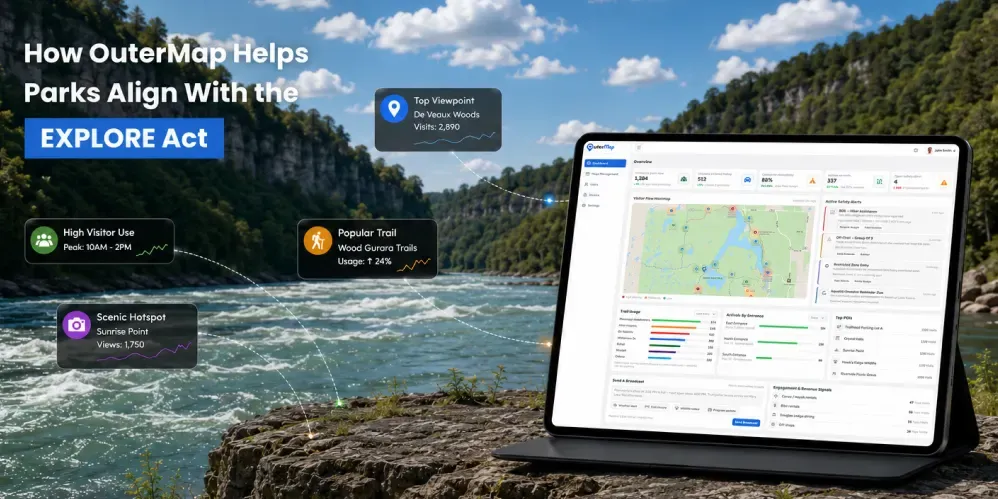
The EXPLORE Act, enacted as Public Law 118-234 on January 4, 2025, includes provisions focused on improving recreation visitation data and using better recreation-use information to support decision-making. Sections 132 and 133 are particularly relevant to this direction.
OuterMap can support this broader data-informed approach by helping parks and recreation organizations provide interactive digital maps, visitor navigation, points of interest, and GPS-based visitor engagement insights.
The goal is simple:
Help visitors explore more confidently while giving park management teams additional visibility into how visitors engage with recreation spaces.
Important note: This article provides general information about the EXPLORE Act and visitor data for parks. It is not legal advice. OuterMap is not a government agency, federal program, or EXPLORE Act compliance solution. Parks and recreation organizations should evaluate their own legal, privacy, operational, and regulatory requirements before implementing visitor data or location-based technology.
Why Visitor Data Matters for Modern Park Management
Managing a recreation destination requires more than knowing how many visitors entered the park.
Traditional visitation methods can provide valuable information through:
- Entrance counts
- Parking counts
- Reservation data
- Visitor surveys
- Trail counters
- Staff observations
- Periodic visitor studies
These methods can provide important information, but they may not provide a complete picture of how visitors move through and interact with a destination.
Consider a visitor who enters a large state park.
They may:
- Hike several trails
- Visit a scenic viewpoint
- Stop at a visitor center
- Use restrooms
- Visit a picnic area
- Attend an activity
- Explore an attraction
- Leave through another part of the park
An entrance count can show that one visitor entered the park. It does not necessarily show which trails, facilities, attractions, or other destinations that visitor engaged with during the visit.
Digital visitor analytics can provide another layer of information.
This can help park teams develop a broader understanding of visitor activity across mapped recreation areas.
What Is the EXPLORE Act?
The Expanding Public Lands Outdoor Recreation Experiences Act, commonly known as the EXPLORE Act, became law as Public Law 118-234 on January 4, 2025.
The law contains a range of provisions related to outdoor recreation, access, public lands, and recreation management. Among those provisions, Sections 132 and 133 are particularly relevant to recreation visitation data and recreation-use monitoring.
The official text of the law is available through the U.S. Government Publishing Office.
For parks and recreation organizations, these provisions are relevant because they reflect a broader federal focus on improving the quality and usefulness of recreation data for decision-making.
What Do Sections 132 and 133 Mean for Recreation Data?
Section 132: Improved Recreation Visitation Data
Section 132 establishes requirements for more consistent visitation data reporting across federal recreational lands and waters and establishes a Real-Time Data Pilot Program for selected recreation areas.
The pilot program is intended to explore ways of making real-time or predictive visitation information available for selected recreation units, including information about visitation within areas of those units where practicable.
The broader direction is:
Better visitation data can support a better understanding of recreation use.
Section 133: Monitoring for Improved Recreation Decision Making
This provision goes beyond simply counting visitors. It focuses on gathering more comprehensive recreation-use information and developing approaches for understanding recreation-use patterns to support decision-making.
This creates an important shift from asking:
"How many visitors came?"
to also asking:
"How are visitors using recreation areas?"
This distinction matters because total visitation numbers provide only one view of recreation use.
Understanding activity across trails, attractions, facilities, and other recreation areas can provide additional context for planning and management.
The Growing Need for Better Visitor Data
As recreation destinations become more popular, park management teams need better information to support decisions related to:
- Trail improvements
- Facility investments
- Visitor services
- Maintenance
- Accessibility
- Safety
- Signage
- Staffing
- Recreation planning
- Resource allocation
Visitor activity is rarely distributed evenly.
One trail may receive significant traffic while another receives relatively little. One attraction may consistently be busy while another remains less visited. A restroom or visitor center may experience higher activity during certain periods.
Understanding these differences can help park teams identify areas that may require further evaluation.
Visitor analytics should not be used as the only basis for these decisions.
Instead, visitor engagement information can become one additional source of evidence alongside operational knowledge, environmental considerations, safety information, maintenance data, surveys, and other park information.
How OuterMap Supports the Data-Informed Direction of the EXPLORE Act
OuterMap combines interactive digital mapping with visitor engagement capabilities to help parks provide a connected visitor experience.
On the visitor side, OuterMap can help visitors:
- Explore trails
- Navigate to destinations
- Find amenities
- Discover points of interest
- Locate facilities
- View activities
- Discover events and visitor information
- Access safety information
- Use offline maps
- Explore mapped destinations
OuterMap's Parks and Recreation platform is designed to support interactive outdoor navigation, visitor engagement, accessibility and safety information, operational visibility, and offline access to maps and points of interest.
On the management side, configured GPS-based analytics can provide additional insight into visitor engagement and activity around mapped locations.
This creates a connected experience:
Visitor explores → Visitor engages → Data is captured → Management gains insight → Park evaluates improvements
OuterMap does not replace official federal visitation reporting, government datasets, agency methodologies, or EXPLORE Act programs.
Instead, it can provide an additional destination-level source of visitor engagement information that parks and recreation organizations can consider alongside other data sources.
1. Understand Visitor Engagement Across Points of Interest
Points of interest are an important part of the visitor experience.
They can include:
- Scenic viewpoints
- Waterfalls
- Historic sites
- Visitor centers
- Educational locations
- Attractions
- Trailheads
- Picnic areas
- Recreation facilities
Depending on the configured experience, OuterMap can provide GPS-based visitor engagement insights around mapped points of interest.
This can help park teams explore questions such as:
Which attractions receive the most visitor engagement?
Which locations receive frequent activity?
Which points of interest appear less engaged with?
Where is visitor activity concentrated?
These insights can become another input for planning and investment discussions.
2. Understand Trail Utilization
Trail networks can be challenging to manage because visitor activity is not always evenly distributed.
Some trails become major visitor destinations while others receive relatively little activity.
With configured visitor analytics, OuterMap can provide additional insight into engagement around mapped trails.
This can help teams understand:
- Which trails receive higher engagement
- Which trails receive lower engagement
- Where visitor activity is concentrated
- Which trails connect popular attractions
- Where additional visitor information may be useful
Over time, this information can support discussions around trail maintenance, signage, accessibility, visitor communication, and future infrastructure.
Visitor analytics should complement, rather than replace, established trail-management practices and on-site knowledge.
3. Understand Amenity and Facility Usage
Visitors interact with more than trails.
They also rely on facilities such as:
- Restrooms
- Visitor centers
- Parking areas
- Picnic areas
- Campgrounds
- Activity locations
- Information points
Visitor engagement data can provide another perspective on how people interact with mapped facilities.
For example, consistently high activity around a facility could encourage management teams to evaluate:
- Capacity
- Maintenance requirements
- Accessibility
- Signage
- Visitor information
- Supporting infrastructure
Analytics alone should not determine investment decisions.
Instead, visitor engagement can be considered alongside maintenance requirements, environmental considerations, accessibility, operational information, and other planning factors.
4. Identify Visitor Traffic Patterns
Visitor activity can change throughout the day and across seasons.
Traffic can be influenced by:
- Weather
- Holidays
- Events
- Seasonal activities
- Trail conditions
- Attractions
- Visitor programs
GPS-based visitor analytics can help organizations understand activity around configured mapped areas.
For example, a management team may identify that a particular attraction consistently receives concentrated visitor engagement during certain periods.
That information can support evaluation of:
- Staffing
- Maintenance
- Visitor communication
- Signage
- Safety
- Facility capacity
The more organizations understand visitor activity patterns, the more information they have when planning for changing demand.
5. Discover Underutilized Recreation Areas
Not every recreation opportunity receives equal visitor attention.
Some destinations become well-known visitor hotspots while other trails, attractions, or facilities receive less attention.
Visitor analytics can help management teams identify these differences.
If a particular attraction receives limited engagement, teams can investigate possible reasons:
- Is it difficult to find?
- Is the trailhead poorly signposted?
- Do visitors know it exists?
- Is the digital information incomplete?
- Is the route difficult to understand?
- Is the attraction disconnected from other popular destinations?
These questions can lead to practical improvements.
Digital maps can also make lesser-known locations easier for visitors to discover by placing them directly within the visitor's exploration experience.
6. Connect Visitor Data With Better Visitor Experiences
The purpose of collecting visitor data should not be limited to management reporting.
The information can also help organizations evaluate opportunities to improve the visitor experience.
For example, if analytics show that visitors frequently engage with a particular area but may have difficulty finding nearby facilities, park teams could consider improving:
- Digital information
- Physical signage
- Wayfinding
- Accessibility information
- Facility visibility
Similarly, if visitors consistently explore a particular attraction, the park could consider providing additional information or connecting that destination with nearby activities.
This creates a continuous improvement cycle:
Visitor behavior → Data → Insight → Improvement → Better visitor experience
7. Support Safety and Risk-Zone Awareness
Visitor data can also contribute to operational awareness.
OuterMap supports configured risk zones and restricted areas within the digital mapping experience. Depending on the configured workflow, activity in designated areas may generate notifications for relevant management teams.
For example:
Visitor enters a configured restricted or risk zone → Management team receives a notification → Team assesses the situation → Ranger team responds when appropriate
This can create an additional layer of operational awareness.
However, this functionality does not replace:
- Official signage
- Park regulations
- Emergency procedures
- Ranger guidance
- Established safety protocols
- Emergency response systems
It should be considered a supporting technology feature within an organization's broader safety and operational processes.
8. Turn Visitor Engagement Into Actionable Park Intelligence
A visitor analytics dashboard becomes more valuable when teams can use the information to ask better questions.
For example:
Visitor engagement
Which attractions receive the most engagement?
Trail usage
Which trails receive higher levels of visitor activity?
Facility engagement
Which mapped amenities receive greater visitor interaction?
Visitor distribution
Where is activity concentrated?
Recreation planning
Which areas may require additional attention or evaluation?
The answers can help management teams develop a more informed picture of how visitors interact with their destinations.
This supports a shift from static visitation numbers toward broader visitor intelligence.
9. Support Data-Informed Recreation Planning
Visitor analytics should not operate in isolation.
Park management teams can combine digital visitor information with other sources such as:
- Reservation data
- Visitor surveys
- Maintenance reports
- Safety reports
- Staff observations
- Trail counters
- Environmental information
- Event participation
- Existing visitation estimates
Together, these sources can provide a broader view of recreation use.
This is particularly relevant to the direction of Section 133, which focuses on comprehensive recreation-use information and understanding recreation-use patterns for improved decision-making.
OuterMap can become one layer within a broader recreation data ecosystem, rather than a replacement for established data systems.
10. Support the Future of Recreation-Use Analysis
The future of visitor analytics can go beyond simply identifying busy locations.
As technology and data practices evolve, recreation organizations can explore deeper visitor-flow analysis, including:
- Visitor flow patterns
- Trail-to-POI movement
- Route analysis
- Peak visitor periods
- Congestion patterns
- Facility engagement trends
- Historical visitor behavior
- Visitor distribution across recreation areas
This can help management teams explore not only where visitors go, but also how visitors move through a destination.
Any advanced analysis should be considered within the appropriate operational, privacy, environmental, and regulatory context.
11. The EXPLORE Act and the Growing Focus on Recreation Data
The EXPLORE Act's recreation-data provisions are part of a broader federal focus on improving recreation visitation information.
In June 2026, the U.S. Department of the Interior announced the first Interagency Recreation Visitation Data Report, described as a unified compilation of recreation visitation estimates across federal land and water management agencies.
The Department also announced 40 proposed pilot projects to test new approaches to measuring recreation use. The announced approaches include mobile-device data, automated counters, GPS units, questionnaires, cameras, community science, and social media.
These developments reinforce an important trend:
Recreation management is becoming increasingly data-informed.
The federal initiatives are focused on federal lands and waters and should not be interpreted as a requirement for every park or recreation organization to use the same technology.
For OuterMap, the relevance is the broader direction toward better recreation data and more informed understanding of visitor use.
OuterMap can support this direction by providing parks and recreation organizations with interactive visitor maps, navigation, location-based information, and configured GPS-based visitor engagement insights.
What This Means for Park Management Teams
For park managers and recreation organizations, the opportunity is not simply to add another digital map.
It is to create a stronger connection between the visitor experience and visitor intelligence.
Visitors get:
- Interactive maps
- Trail navigation
- Offline maps
- Points of interest
- Amenities
- Activities
- Visitor information
- Safety information
- Digital destination discovery
Park management teams can gain:
- Visitor engagement insights
- GPS-based activity information
- POI engagement insights
- Amenity engagement information
- Trail engagement information
- Risk-zone awareness
- Configured management notifications
- A foundation for future visitor-flow analysis
This creates a two-sided digital experience:
Better information for visitors. Better visibility for park teams.
OuterMap Is a Supporting Technology Layer, Not an EXPLORE Act Compliance Tool
It is important to distinguish between supporting a data-informed direction and claiming compliance with federal legislation.
The EXPLORE Act establishes federal requirements, programs, and processes concerning recreation visitation data and recreation-use monitoring.
OuterMap does not replace:
- Federal reporting systems
- Official agency methodologies
- Government visitation datasets
- Federal recreation programs
- Established park measurement systems
Instead, OuterMap can help individual parks and recreation organizations:
- Provide interactive visitor information
- Capture configured visitor engagement information
- Understand activity around mapped locations
- Analyze GPS-based visitor insights
- Improve digital visitor experiences
- Identify potential areas for further evaluation
- Add another information layer for data-informed recreation management
In simple terms:
The EXPLORE Act establishes federal programs and requirements. OuterMap provides technology that can support visitor experience and location-based information needs alongside those broader efforts.
The Future of Park Management Is More Data-Informed
Outdoor recreation is changing.
Visitors increasingly expect:
- Mobile navigation
- Easy-to-find information
- Digital maps
- Offline access
- Safety information
- Activity discovery
- Accessible visitor experiences
At the same time, management teams need better information to understand:
- Visitor demand
- Trail utilization
- Facility engagement
- Visitor activity
- Recreation patterns
- Emerging operational challenges
The EXPLORE Act reflects a broader federal focus on improving recreation data.
Recent federal initiatives also demonstrate continued interest in developing better ways to understand how people use popular and lesser-known recreation areas.
OuterMap can support this broader transformation by connecting digital visitor experiences with visitor engagement insights.
From Better Maps to Better Park Decisions
A digital map should not only answer:
"Where am I?"
It can also help park teams explore:
"How are visitors engaging with this destination?"
OuterMap brings these two perspectives together.
For visitors:
Explore → Navigate → Discover → Experience
For management teams:
Capture → Analyze → Understand → Evaluate
This creates an opportunity to use visitor engagement information as one additional input for recreation planning and visitor experience improvements.
Ready to Make Visitor Data More Actionable?
OuterMap helps parks and recreation organizations transform static maps into interactive digital visitor experiences while providing configured visitor engagement insights through GPS-based analytics.
Visitors can use OuterMap to navigate trails, discover amenities, explore points of interest, find activities, access safety information, and use maps when connectivity is limited.
Park management teams can gain additional visibility into how visitors engage with mapped destinations and use those insights alongside other information sources for planning and improvement.
Better maps for visitors. Better information for park teams. Better-informed decisions for the future.
Explore OuterMap for Parks and Recreation
Frequently Asked Questions
1. What is the EXPLORE Act?
The EXPLORE Act, or Expanding Public Lands Outdoor Recreation Experiences Act, is a U.S. federal law enacted as Public Law 118-234 on January 4, 2025. The law includes provisions related to outdoor recreation, access, public lands, recreation management, and recreation data. The official text of the law is available through the U.S. Government Publishing Office.
2. How does the EXPLORE Act relate to visitor data?
The EXPLORE Act includes provisions focused on improving recreation visitation data and recreation-use monitoring. Section 132 addresses improved recreation visitation data and establishes a Real-Time Data Pilot Program, while Section 133 focuses on monitoring recreation use and supporting improved recreation decision-making through more comprehensive recreation information.
3. How can OuterMap help parks with visitor data?
OuterMap can help parks and recreation organizations provide interactive digital maps and gain configured GPS-based visitor engagement insights around mapped trails, points of interest, amenities, attractions, facilities, and other destinations. These insights can provide an additional source of information that park management teams can consider when evaluating visitor experiences and recreation planning.
4. What type of visitor information can OuterMap provide?
Depending on the configured OuterMap experience, the platform can provide GPS-based insights related to visitor engagement and activity around mapped trails, points of interest, amenities, attractions, facilities, and other destinations. This information can help park management teams better understand visitor activity across different areas of a recreation destination.
5. Does OuterMap replace official park visitation data?
No. OuterMap does not replace official federal visitation reporting, government datasets, agency methodologies, visitor counts, or other established measurement systems. Instead, it can provide an additional source of destination-level visitor engagement information that parks and recreation organizations may consider alongside surveys, counters, reservations, staff observations, maintenance data, and other sources.
6. Can OuterMap help park managers understand trail usage?
Yes. Depending on the configured experience, OuterMap can provide GPS-based visitor engagement insights around mapped trails, helping park management teams identify areas with higher or lower visitor activity. These insights can provide additional information for evaluating trail communication, visitor services, maintenance, accessibility, and broader recreation planning.
7. Can visitor data help parks improve infrastructure?
Yes. Visitor data can provide an additional source of evidence when parks evaluate infrastructure and facility priorities. For example, higher visitor engagement around a trail, attraction, or amenity may identify an area for further evaluation. However, infrastructure decisions should also consider factors such as maintenance requirements, environmental conditions, safety, accessibility, operational needs, and professional judgment.
8. Can OuterMap support recreation-use analysis?
OuterMap can provide GPS-based visitor engagement information that may contribute to broader recreation-use analysis. The usefulness of this information for advanced visitor-flow or recreation-use modeling depends on the available data, analytical methodology, configuration, privacy requirements, and other systems used by the organization.
9. How can visitor analytics improve the visitor experience?
Visitor analytics can help parks identify areas of higher engagement, less-engaged destinations, and potential information or navigation gaps. Management teams can use these insights alongside other information to evaluate improvements to digital maps, signage, wayfinding, accessibility information, facilities, visitor services, and other aspects of the visitor experience.
10. Does OuterMap support visitor safety?
OuterMap can support configured digital safety features such as risk zones and restricted areas. Depending on the configured workflow, activity within designated areas may generate notifications for relevant management teams. These features are intended to complement, not replace, official signage, park regulations, emergency procedures, ranger guidance, and established safety protocols.
11. Does OuterMap use QR-code scans to measure visitor traffic?
No. QR codes can be used as an access point for visitors to open an OuterMap experience, but QR-code scans should not be described as the method used to measure visitor traffic. Configured GPS-based capabilities provide the relevant visitor engagement and activity insights.
12. Is OuterMap an official EXPLORE Act partner?
No official partnership should be implied unless a documented relationship exists. OuterMap should not be described as an official EXPLORE Act partner, government-approved provider, or government-endorsed solution without appropriate official documentation. OuterMap is a private technology platform that can support digital mapping, visitor navigation, and configured visitor engagement capabilities.
13. Does using OuterMap make a park compliant with the EXPLORE Act?
No. Using OuterMap does not by itself make a park or recreation organization compliant with the EXPLORE Act. OuterMap should not be presented as an EXPLORE Act compliance solution or a replacement for federal reporting systems, agency requirements, or official government programs. Organizations should evaluate their own legal, privacy, operational, and regulatory requirements.
14. What is the future of visitor data for parks?
The future of visitor data for parks is moving toward a more comprehensive understanding of recreation use, including visitor activity, trail utilization, facility engagement, visitor distribution, and visitor-flow patterns. Recent federal recreation-data initiatives also demonstrate continued interest in improving how recreation use is measured and understood. Technologies such as digital maps and GPS-based analytics can provide additional information to support this broader data-informed approach.