7 Reasons Park Visitors Get Confused & How Digital Wayfinding Helps
Park visitors can become confused when large outdoor spaces have multiple trails, entrances, facilities, and attractions. Digital wayfinding adds an interactive layer to traditional maps and signs, helping visitors find destinations, explore routes, and access useful park information more easily.
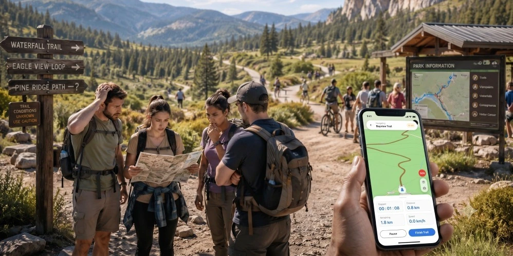
For many park visitors, confusion can begin before they even start their first trail. After traveling to a park, visitors want to find the right entrance, parking area, trailhead, campsite, or activity without spending the first part of their visit figuring out where to go.
Printed maps and physical signs are still valuable, but they cannot answer every question a visitor may have. Trail information, facilities, closures, events, and points of interest can be difficult to find or spread across different sources.
Today's visitors are also accustomed to using digital maps in their everyday lives. They expect convenient navigation and useful information when exploring unfamiliar places.
This is where a digital park wayfinding platform can help. An interactive digital map can give visitors a clearer view of the park, help them find destinations, and provide useful information throughout their visit.
Why Do Visitors Get Confused in Parks?
Large outdoor spaces can be difficult to navigate because they often contain multiple entrances, parking areas, trails, facilities, activity zones, and points of interest.
Visitors may struggle to:
- Find the correct entrance or parking area
- Locate the right trailhead
- Choose a suitable trail
- Find restrooms and other facilities
- Discover viewpoints and attractions
- Navigate when connectivity is limited
- Find current information about closures or events
When visitors cannot find what they need, they may ask staff for directions, call the visitor center, or spend unnecessary time trying to understand the park layout.
A well-designed digital wayfinding solution can reduce many of these navigation challenges.
What Do Modern Park Visitors Expect?
Visitors increasingly use smartphones to plan and navigate their trips.
Before arriving, they may want to:
- Explore the park layout
- Preview trails and attractions
- Find parking and entrances
- Learn about available facilities
- Plan their visit around activities or events
Once inside the park, they may want to:
- Navigate to a trailhead or campsite
- Find restrooms and picnic areas
- Discover viewpoints and attractions
- Access trail information
- Receive relevant updates
- Continue using maps where connectivity is limited
Instead of providing only a static map, parks can provide a digital experience that supports visitors from arrival to departure.
What Is Digital Park Wayfinding?
Digital park wayfinding uses interactive maps, location information, routes, and points of interest to help visitors navigate outdoor environments.
An interactive park map can show trails, parking areas, facilities, attractions, viewpoints, campsites, and other destinations in one digital experience.
Depending on the platform and configuration, visitors can search for locations, view routes, access trail information, and use maps offline.
For park operators, outdoor wayfinding software can also make it easier to manage map information and communicate changes to visitors.
7 Reasons Park Visitors Get Confused
1. There Is No Interactive Park Map
A printed trail map provides an overview, but visitors may still have difficulty understanding exactly where they are or how different locations connect.
How digital wayfinding helps:
- Turns an existing park map into an interactive digital experience
- Displays trails and points of interest
- Makes important locations searchable
- Helps visitors better understand the park layout
A digital map gives visitors a more flexible way to explore the park instead of relying entirely on a static map.
2. Entrances and Trailheads Are Difficult to Find
Large parks may have multiple entrances, parking areas, trailheads, and access points. If these locations are not clearly identified, visitors can become confused before they even begin exploring.
A digital wayfinding platform can help visitors identify:
- Entrances
- Parking areas
- Trailheads
- Check-in points
- Gates
- Key landmarks
This can make arrivals smoother and help visitors start their planned activities more confidently.
3. Visitors Cannot Easily Find the Right Trail
A park may have trails with different lengths, difficulty levels, surfaces, elevations, or accessibility characteristics.
Without clear information, visitors may select a trail that does not match their needs or expectations.
A digital map can organize trail information and help visitors understand their options before they start.
Where supported, trail information can include:
- Distance
- Difficulty
- Elevation
- Surface type
- Accessibility
- Open or closed status
This gives visitors more information when deciding which route to explore.
4. Connectivity Disappears on the Trail
A digital navigation experience is less useful if visitors lose access to it when they leave an area with cellular coverage.
This is why offline capability can be important for outdoor destinations.
With an offline digital wayfinding solution, visitors can download relevant map information before entering areas with limited connectivity. OuterMap's current park platform states that maps and POI data can be downloaded to the device so visitors can continue using navigation and location information offline.
5. Important Facilities Are Difficult to Discover
Visitors may know that a park has restrooms, picnic areas, campsites, viewpoints, or other facilities, but still struggle to find them.
An interactive map can make these locations searchable and easier to discover.
Examples include:
- Restrooms
- Picnic areas
- Campsites
- Visitor centers
- Parking
- Food areas
- Viewpoints
- Recreation facilities
This can reduce unnecessary walking and repetitive questions directed toward park staff.
6. Visitors Miss Attractions, Activities, and Points of Interest
Visitors may focus on the main trail or attraction and miss other experiences nearby.
A digital wayfinding platform can highlight:
- Scenic viewpoints
- Nature areas
- Educational locations
- Activities
- Events
- Recreation zones
- Points of interest
This turns the map into more than a navigation tool. It can also become a discovery tool that encourages visitors to explore more of the park.
7. Park Information Changes but Visitors Do Not See the Update
Trails close, maintenance work begins, weather conditions change, events are rescheduled, and certain areas may become temporarily restricted.
Printed information cannot always keep pace with these changes.
A digital system gives park teams a way to update relevant map and location information centrally.
OuterMap's current park platform states that administrators can update trail or POI status and schedule closures through its dashboard.
This can help visitors access more current information without depending entirely on physical signage.
Benefits of Digital Wayfinding for Park Operators
Digital navigation is not only about helping visitors find their way. It can also support park operations.
Reduce Repetitive Direction Questions
Visitors can independently search for common destinations and facilities.
Improve Visitor Flow
Clearer navigation can help visitors move more efficiently between entrances, parking areas, trails, and attractions.
Make Attractions Easier to Discover
Interactive maps can highlight locations visitors may otherwise overlook.
Keep Information Updated
Digital map and content updates can reduce the need to replace printed information every time something changes.
Improve Accessibility Information
Where appropriate data is available, digital maps can help visitors identify accessible routes and facilities. OuterMap currently lists accessibility guidance among its wayfinding capabilities.
Create a More Connected Visitor Experience
A digital map can bring navigation, points of interest, trail information, facilities, and visitor updates together in one experience.
What Should You Look for in Outdoor Wayfinding Software?
When evaluating outdoor wayfinding software, park operators should focus on practical capabilities rather than simply choosing the platform with the most features.
Interactive Outdoor Maps
The platform should make trails, facilities, attractions, and other locations easy to understand.
Search and Location Discovery
Visitors should be able to search for important destinations instead of manually scanning the entire map.
Trail Navigation
The system should support the park's outdoor routes and relevant trail information.
Offline Navigation
This is particularly important for parks and remote outdoor destinations where cellular connectivity can be unreliable.
Accessibility Support
Look for the ability to provide information about accessible routes and facilities where applicable.
Easy Map Management
Park teams should be able to update locations, routes, closures, and other information without rebuilding the entire digital map.
Mobile Access
Visitors should have a convenient way to access the experience through their smartphones or other supported devices.
Why Choose OuterMap for Park Wayfinding?
OuterMap provides digital wayfinding for parks and outdoor environments, combining interactive maps, navigation, points of interest, accessibility guidance, and visitor engagement capabilities.
Turn an Existing Park Map Into an Interactive Map
OuterMap's current park offering is designed to help organizations use existing maps as the foundation for a digital outdoor navigation experience.
Support Offline Outdoor Navigation
Visitors can download map and POI data for offline use, which is particularly useful for parks and trails with limited connectivity.
Make Trails and Points of Interest Easier to Find
Park maps can include trails, facilities, attractions, viewpoints, and other important locations so visitors can find them more easily.
Keep Park Information Current
Park teams can update mapped locations and statuses through the centralized administration experience.
Support a Better Visitor Experience
OuterMap is designed to help parks make outdoor spaces easier to explore while also supporting accessibility, safety information, and operational needs.
Conclusion
Visitors come to parks to explore, relax, and enjoy the outdoors—not to spend their time trying to understand a confusing trail map or searching for a hard-to-find facility.
Digital wayfinding software can make the experience easier by helping visitors find trails, navigate to destinations, discover points of interest, access important information, and continue using maps where connectivity is limited.
For park operators, digital wayfinding solutions can also reduce repetitive navigation questions, simplify map updates, improve visitor communication, and create a more connected experience.
The goal is not to eliminate physical signs and printed maps. Instead, digital navigation adds an interactive layer that helps fill the gaps those traditional tools cannot address.
OuterMap helps parks turn existing maps into interactive digital experiences, making outdoor spaces easier to navigate and explore.
Frequently Asked Questions
What is digital park wayfinding?
Digital park wayfinding uses interactive maps, routes, location information, and points of interest to help visitors navigate parks and other outdoor environments.
How does digital wayfinding help park visitors?
It can help visitors find entrances, parking areas, trailheads, facilities, attractions, and other destinations while providing a more convenient alternative to relying only on printed maps and signs.
What is outdoor wayfinding software?
Outdoor wayfinding software helps organizations provide digital navigation across outdoor environments such as parks, trails, recreational areas, botanical gardens, and nature destinations.
Can digital wayfinding work without cell service?
Yes, if the platform supports offline maps and navigation. Visitors can download the required map information before entering areas with limited connectivity.
Can I turn my existing park map into an interactive map?
Yes. Platforms such as OuterMap are designed to help organizations transform existing maps into interactive digital experiences for visitors.
What is the difference between a park map and a digital wayfinding platform?
A traditional park map mainly shows the layout of an area. A digital wayfinding platform can add search, navigation, points of interest, route information, updates, and other interactive capabilities.
Can digital wayfinding be used in theme parks?
Yes. Wayfinding software for theme parks can help visitors locate rides, attractions, restaurants, restrooms, entrances, entertainment areas, and other destinations across large properties.
How can OuterMap help parks?
OuterMap helps parks create interactive outdoor navigation experiences using digital maps, trails, points of interest, offline navigation, accessibility information, and centralized map management.