How Digital Wayfinding Helps Passengers Navigate Large Airports
Large airports can be difficult to navigate, especially for passengers visiting an unfamiliar terminal. Finding the right gate, reaching security, locating baggage claim, changing terminals, or finding ground transportation can become challenging when a journey involves multiple levels, long corridors, or several connected buildings.
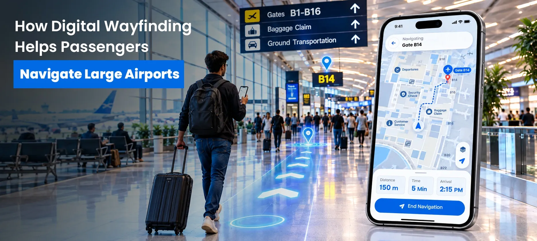
Traditional signs and printed maps remain important parts of airport navigation. However, digital wayfinding can provide another layer of guidance by helping passengers search for destinations, understand their location, view routes, and find important services through interactive digital maps.
What Is Airport Wayfinding?
Airport wayfinding is the process of helping passengers understand where they are, identify where they need to go, and follow a clear route to their destination.
In a large airport, this can include navigating between:
- Entrances and check-in areas
- Security checkpoints
- Departure gates
- Connecting gates
- Baggage claim areas
- Restrooms
- Restaurants and shops
- Lounges
- Information desks
- Ground transportation
- Parking areas
- Accessibility-related facilities
A well-planned airport wayfinding system can bring these different navigation points together so passengers can better understand the terminal environment.
Why Is Airport Navigation Difficult in Large Airports?
Airports are not always simple point-to-point environments. A passenger may need to move through multiple areas, levels, buildings, or transportation connections before reaching a destination.
For example, a departing passenger may need to follow this journey:
Airport Entrance → Check-In → Security → Terminal Area → Gate
An arriving passenger may follow a different path:
Gate → Baggage Claim → Exit → Ground Transportation
A connecting passenger may have another route:
Arrival Gate → Connecting Area → Security or Transfer Point → Departure Gate
These different journeys can make airport navigation more complicated, particularly in large airports with multiple terminals, concourses, floors, and facilities.
Digital wayfinding can complement traditional signs and help passengers understand their surroundings before and during their journey.
How Digital Wayfinding Helps Passengers
Digital wayfinding can make airport navigation more interactive by allowing passengers to search for destinations and understand routes through digital maps.
1. Helps Passengers Find Important Destinations
Passengers may need to find much more than their departure gate.
They may also need directions to a restroom, restaurant, lounge, baggage claim area, information desk, or transportation connection.
With interactive airport maps, passengers can search for relevant locations instead of trying to identify every destination from static signs.
This can make it easier to find important facilities throughout a complex airport environment.
2. Makes Large Terminal Layouts Easier to Understand
Large airport terminals can contain multiple concourses, floors, entrances, and connected areas.
A digital map can provide a visual representation of these spaces and help passengers understand the relationship between their current location and their destination.
This can be particularly useful when a route involves a change of level or movement between different areas of a terminal.
Instead of relying only on a series of signs, passengers can use a digital map to develop a clearer understanding of the overall layout.
3. Supports Indoor Airport Navigation
GPS-based navigation is useful outdoors, but airport terminals can present different navigation challenges.
Airport indoor navigation focuses on helping users understand routes within buildings and other indoor environments.
For example, an indoor navigation experience can help a passenger understand how to move from one terminal location to another while considering the layout of the building.
The goal is not simply to display a map. It is to make the route easier to understand and follow.
4. Helps Connecting Passengers
Passengers with connecting flights often need to move from one part of an airport to another within a limited amount of time.
They may need to find a new gate, move between concourses, change levels, or locate another checkpoint.
An airport wayfinding system can help passengers identify their destination and understand the route before they begin walking.
Digital maps can be particularly useful in airport environments where passengers need to travel long distances or move between different areas of a terminal.
5. Helps Passengers Find Amenities and Services
Airport navigation is not limited to gates and terminals.
Passengers may also need to locate:
- Restaurants and cafés
- Retail stores
- Restrooms
- Lounges
- Charging areas
- Information points
- Baggage services
- Transportation connections
- Parking facilities
- Other important points of interest
An interactive airport map can bring these locations into one searchable experience.
This can make it easier for passengers to discover relevant points of interest while they move through the airport.
6. Supports More Accessible Navigation
Navigation can be more challenging for passengers with different mobility, visual, or other accessibility needs.
Digital maps can help present accessibility-related information and, where accurate route and facility data is available, help users identify suitable destinations or routes.
For airports, accessibility information should be accurate, clearly presented, and maintained as facilities and routes change.
Providing useful accessibility information through digital maps can help passengers better understand the options available within an airport.
7. Provides Another Way to Access Navigation Information
Physical signs are still an essential part of airport wayfinding. Digital tools should not be viewed as a replacement for every sign or directory.
Instead, digital wayfinding can complement the airport's existing navigation system.
A passenger may notice a physical sign, check an interactive map for additional information, and then follow the physical signage to the destination.
This combination provides passengers with multiple ways to understand where they are and where they need to go.
What Can an Interactive Airport Map Show?
The usefulness of an interactive airport map depends on the information available for the airport and how that information is organized.
Depending on the implementation, an airport map may help users find:
- Terminals and concourses
- Gates
- Security checkpoints
- Baggage claim
- Restrooms
- Restaurants
- Shops
- Lounges
- Parking
- Ground transportation
- Information points
- Accessibility-related facilities
- Other important points of interest
The most useful information will depend on the airport's layout and passenger needs.
For example, a connecting passenger may primarily need gate and terminal information, while an arriving passenger may be more interested in baggage claim and ground transportation.
Digital Airport Maps and the Passenger Journey
A useful digital airport map should support passengers throughout different stages of their journey.
Before Entering the Terminal
Passengers can use digital information to understand the airport layout and identify relevant locations.
During Departure
They may need to find check-in, security, their gate, food, restrooms, or other services.
During a Connection
They may need to move between gates or areas within a limited amount of time.
After Arrival
They may need directions to baggage claim, exits, parking, rental cars, public transportation, or passenger pickup areas.
This means airport wayfinding should be designed around real passenger journeys, not simply around displaying a map.
Digital Wayfinding vs. Traditional Airport Signs
Digital wayfinding does not make traditional airport signs unnecessary.
Physical signs provide immediate guidance throughout the terminal, while digital tools can provide additional information and interactive assistance.
| Traditional Wayfinding | Digital Wayfinding |
|---|---|
| Fixed signs | Interactive maps |
| Printed directories | Searchable destinations |
| Static information | Interactive information |
| General directional guidance | Destination-specific guidance |
| Physical map displays | Digital map experiences |
The two approaches can work together.
A passenger may notice a physical sign, check an interactive map for more detail, and then follow the physical signage to the destination.
This layered approach can help airports address different passenger needs and navigation situations.
What Should Airports Consider When Implementing Digital Wayfinding?
A successful airport wayfinding system requires more than simply adding an interactive map.
Airports should consider several factors.
Accurate Location Information
Maps and points of interest should accurately represent the airport environment.
Outdated information can create confusion instead of reducing it.
Clear Information Architecture
Passengers should be able to quickly find the information they need without navigating through unnecessary steps.
Different Passenger Journeys
Departing, arriving, and connecting passengers may have different navigation requirements.
A digital wayfinding experience should consider these different passenger journeys when organizing destinations and routes.
Accessibility
Accessibility information should be clear and based on accurate facility and route data.
Mobile-Friendly Experiences
Passengers often use smartphones while traveling, so digital airport maps should be easy to access and use on smaller screens.
Ongoing Content Management
Airport environments change. Gates, facilities, routes, construction areas, and points of interest can change over time.
Digital wayfinding therefore requires ongoing information management to remain useful.
How OuterMap Supports Digital Wayfinding
OuterMap provides digital mapping and wayfinding capabilities designed to help organizations present locations, routes, points of interest, and navigation information through interactive map experiences.
For complex environments, digital maps can provide users with a clearer way to explore locations and understand available routes.
OuterMap supports digital navigation experiences with capabilities such as:
- Interactive maps
- Indoor and outdoor navigation
- Location search
- Route guidance
- Points of interest
- Accessibility information where mapped
- Visitor engagement
For an airport environment, the exact information and navigation experience would depend on the airport's available map data, locations, routes, facilities, and implementation requirements.
Benefits of Digital Airport Wayfinding
When thoughtfully implemented, digital wayfinding can provide several potential benefits for airports and passengers.
Better Access to Navigation Information
Passengers can access location and route information in an interactive format.
Easier Discovery of Airport Facilities
Searchable maps can help passengers find services and points of interest.
Support for Complex Terminal Environments
Digital maps can help users understand larger and more complicated spaces.
More Focused Navigation
Instead of showing every location at once, a digital experience can focus on the destination a passenger is looking for.
Support for Accessibility Information
Digital maps can make relevant accessibility information easier to find when accurate data is available.
Useful Insights Into Visitor Needs
Where an interactive wayfinding system includes appropriate analytics, aggregated usage information can help organizations understand which locations or searches are important to users.
Frequently Asked Questions
1. What is an airport wayfinding system?
An airport wayfinding system combines navigation tools such as signs, maps, directories, and potentially digital or interactive technologies to help people move through an airport.
2. How does digital wayfinding help airport passengers?
Digital wayfinding can help passengers search for destinations, view interactive maps, understand routes, and locate gates, services, amenities, and other points of interest.
3. What is airport indoor navigation?
Airport indoor navigation helps users navigate inside airport buildings and terminals. It can help passengers understand routes between locations such as gates, security areas, baggage claim, and other facilities.
4. What are interactive airport maps?
Interactive airport maps allow users to explore airport locations digitally and can provide searchable information about destinations, facilities, amenities, and routes.
5. Can digital wayfinding support accessible navigation?
Yes. Digital maps can present accessibility-related information and, where accurate route and facility data is available, help users identify relevant destinations or routes. The quality of the experience depends on accurate mapping data and the airport's accessibility requirements.
Conclusion
Navigating a large airport can involve multiple destinations, long walking routes, different levels, and changing passenger needs. Traditional signs and directories remain important, but digital wayfinding can add an interactive layer that helps passengers search for destinations, understand airport layouts, and access navigation information.
From finding a departure gate to locating baggage claim, ground transportation, amenities, or accessibility-related facilities, digital airport maps and airport wayfinding systems can help make complex airport environments easier to understand.
For airports exploring digital navigation, the goal should be more than simply putting a map online. The experience should provide accurate information, clear routes, useful points of interest, accessibility information where available, and an easy way for passengers to find what they need.
With the right information and implementation, digital wayfinding can become a useful part of a broader airport navigation strategy.