Beyond Paper Maps: How Interactive Mapping Transforms Recreation Park Visitor Experiences
Recreation parks can use interactive mapping to make existing maps more useful for today's digital visitors. By connecting trails, campsites, facilities, activities, and points of interest, digital maps can make park exploration easier and more convenient.
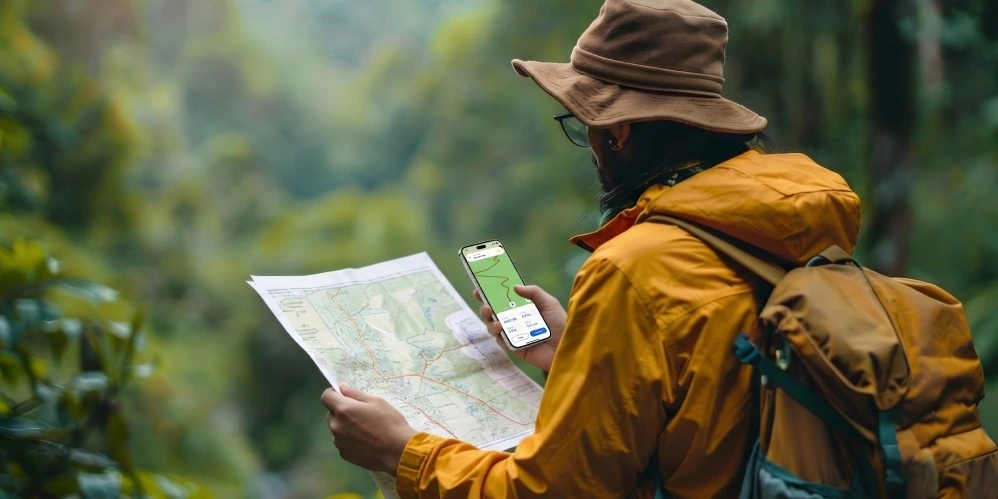
For decades, paper maps have helped visitors navigate national parks, recreation areas, campgrounds, nature reserves, and other outdoor destinations. They provide a useful overview of trails, campsites, picnic areas, facilities, and major attractions.
But a printed map can only provide so much information.
Today's visitors are accustomed to using digital maps to find destinations, plan routes, and discover nearby places. When they visit a recreation park, they increasingly expect the same convenience.
Interactive mapping can transform a traditional park map into a digital experience that helps visitors find trails, campsites, facilities, activities, and points of interest from their mobile devices.
For recreation park operators, this creates an opportunity to improve navigation and visitor engagement while making park information easier to manage.
Why Traditional Park Maps Are No Longer Enough
Printed maps remain useful for general orientation and situations where physical information is needed. However, they have several limitations when visitors need specific guidance.
Visitors may struggle to:
- Find the correct entrance or parking area
- Navigate large recreation areas
- Locate campsites and facilities
- Discover nearby attractions
- Understand trail options
- Find updated information
- Plan activities during their visit
Many parks now provide PDF maps online. While this makes the map easier to access, a PDF is still essentially a static document.
Visitors may still need to switch between different websites or applications to check reservations, activities, trail information, directions, and other details.
An interactive park map can bring more of this information together in one digital experience.
What Do Modern Outdoor Visitors Expect?
Visitors increasingly use smartphones before and during their trips.
Before arriving, they may want to:
- Preview the park layout
- Find entrances and parking
- Explore campsites
- Browse trails
- Discover activities and attractions
- Understand available facilities
Once inside the park, they may want to:
- Navigate to their destination
- Find nearby points of interest
- Locate restrooms and picnic areas
- Discover trails and viewpoints
- Access important visitor information
This changes the role of a park map.
Visitors no longer need only a map that tells them where things are. They can benefit from a digital experience that also helps them find and explore those locations.
What Is Interactive Mapping for Recreation Parks?
Interactive mapping transforms a traditional park map into a digital experience that visitors can explore and use on supported devices.
Instead of simply viewing static locations, visitors can interact with the map, search for destinations, explore points of interest, and access route information.
An interactive mapping platform can bring together elements such as:
- Trails
- Campsites
- Parking
- Facilities
- Attractions
- Viewpoints
- Recreation areas
- Visitor centers
The result is a more flexible way for visitors to understand and explore a recreation park.
How Interactive Mapping Helps Recreation Parks
1. Simplifies Arrival and Entrance Navigation
The visitor experience begins before they reach their destination.
In a large recreation park, visitors may need to find the correct entrance, parking area, campground, check-in location, or accommodation.
An interactive map can help visitors identify these locations before arrival and navigate toward them once they reach the property.
This can make arrivals smoother and reduce basic navigation questions for staff.
2. Makes Trail Discovery Easier
Recreation parks often contain multiple trails with different distances, difficulty levels, scenery, and activities.
Interactive mapping software can organize these routes in a way that makes them easier to explore.
Visitors can use the map to:
- Discover nearby trails
- Compare available routes
- Find viewpoints
- Identify trail-related points of interest
- Understand the overall trail layout
This gives visitors more information when deciding where they want to explore.
3. Helps Visitors Find Campsites and Lodging
For campgrounds and recreation destinations, booking a campsite is only part of the visitor experience.
Guests may also need to understand where their site is located, what facilities are nearby, and how to reach it.
An interactive map can display:
- Campsite locations
- Accommodation areas
- Restrooms
- Showers
- Parking
- Recreation facilities
- Nearby attractions
This can make the arrival and check-in experience easier and help guests understand the property before they arrive.
4. Connects Activities With Navigation
Recreation parks often offer more than trails and campsites. Activities, events, guided experiences, and seasonal attractions can also be an important part of the visitor experience.
Instead of presenting activity information separately, an interactive mapping solution can connect activities with their physical locations.
Visitors can discover an activity and then find where it takes place on the map.
This creates a smoother connection between discovery and navigation.
5. Supports Better Outdoor Navigation
Large recreation areas can be difficult to navigate, especially for first-time visitors.
Digital maps can help visitors understand their surroundings and identify important locations along their journey.
Depending on the platform, capabilities may include route information, offline maps, points of interest, and other navigation features.
This can give visitors greater confidence while exploring unfamiliar areas.
From Static Maps to Interactive Digital Experiences
One of the simplest ways for recreation parks to adopt digital mapping is to use their existing map as the starting point.
Instead of completely replacing an established map, organizations can transform static maps into interactive maps by adding digital locations, points of interest, routes, and visitor information.
This approach can help preserve the familiar layout of the existing park map while making it more useful for today's digital visitors.
An interactive mapping platform can provide the tools needed to organize this information and deliver it through a digital visitor experience.
What to Look for in Interactive Mapping Software
When choosing interactive mapping software, recreation park operators should focus on practical capabilities that support their visitors and staff.
Easy-to-Use Interactive Maps
The map should be simple enough for visitors to understand without extensive instructions.
Outdoor and Trail Support
The platform should support trails, roads, paths, attractions, facilities, and other outdoor locations relevant to the park.
Points of Interest
Visitors should be able to discover important facilities, attractions, viewpoints, campsites, and activities.
Mobile Access
Visitors should have a convenient way to access the map through their smartphones or other supported devices.
Offline Capabilities
Offline access can be particularly valuable for outdoor destinations where connectivity may be limited.
Easy Content Management
Park teams should be able to update locations, information, and other map content as the property changes.
Benefits for Recreation Park Operators
Interactive mapping can improve more than visitor navigation.
Fewer Repetitive Questions
Visitors can independently find common destinations and facilities.
Easier Information Management
Digital information can be updated without redesigning or reprinting every physical map.
Better Attraction Discovery
Operators can make trails, activities, viewpoints, and other locations more visible.
More Connected Visitor Experiences
Maps, locations, activities, and visitor information can be brought together into one digital experience.
Better Support for Large Outdoor Spaces
A digital map can make complex recreation areas easier for visitors to understand and explore.
Why Choose OuterMap for Recreation Park Mapping?
OuterMap provides an interactive mapping platform that helps organizations turn existing maps into interactive digital experiences.
Transform Existing Maps Into Interactive Experiences
Recreation parks can use existing maps as the foundation for a digital visitor experience instead of creating an entirely new map from scratch.
Support Trails and Points of Interest
Important locations such as trails, campsites, facilities, viewpoints, attractions, and recreation areas can be organized within the digital map.
Make Navigation More Convenient
Visitors can use the interactive map to explore the park, find destinations, and better understand the surrounding area.
Support Outdoor Environments
OuterMap supports outdoor wayfinding use cases, making it suitable for recreation parks and other large outdoor destinations.
Create a Better Visitor Experience
By adding a digital layer to an existing park map, OuterMap helps recreation destinations provide visitors with a more convenient and engaging way to explore the property.
Conclusion
Paper maps continue to have a place in recreation parks, but today's visitors increasingly expect more convenient digital experiences.
For park operators, interactive mapping solutions can also make visitor information easier to manage and provide a modern digital layer without necessarily replacing existing maps, signs, or infrastructure.
Whether you manage a national park, campground, nature reserve, botanical garden, or outdoor recreation destination, moving beyond static maps can create a more connected visitor experience.
OuterMap helps recreation parks transform existing maps into interactive digital experiences, making it easier for visitors to explore, navigate, and enjoy everything the destination has to offer.
Frequently Asked Questions
What is interactive mapping for recreation parks?
Interactive mapping allows recreation parks to turn traditional maps into digital experiences where visitors can explore locations, search for destinations, discover points of interest, and access navigation information.
How can interactive maps improve the visitor experience?
Interactive maps can make it easier for visitors to find trails, campsites, facilities, attractions, activities, and other destinations while exploring a recreation park.
What is interactive mapping software?
Interactive mapping software provides tools for creating, managing, and delivering digital maps that users can explore and interact with.
Can a park turn an existing static map into an interactive map?
Yes. Existing maps can be used as the foundation for a digital map and enhanced with locations, points of interest, routes, and other visitor information.
Can interactive maps support campsite navigation?
Yes. Campsites can be added as locations on an interactive map, allowing visitors to find their reserved site and understand nearby facilities and destinations.
Can interactive mapping be used for hiking trails?
Yes. Interactive maps can display hiking trails, viewpoints, facilities, and other trail-related points of interest to help visitors explore outdoor areas.
What is an interactive mapping platform?
An interactive mapping platform is a digital system that allows organizations to create, manage, and publish interactive maps for visitors, customers, staff, or other users.
How can OuterMap help recreation parks?
OuterMap helps organizations transform existing maps into interactive digital experiences that can include trails, campsites, facilities, attractions, points of interest, and outdoor navigation.